
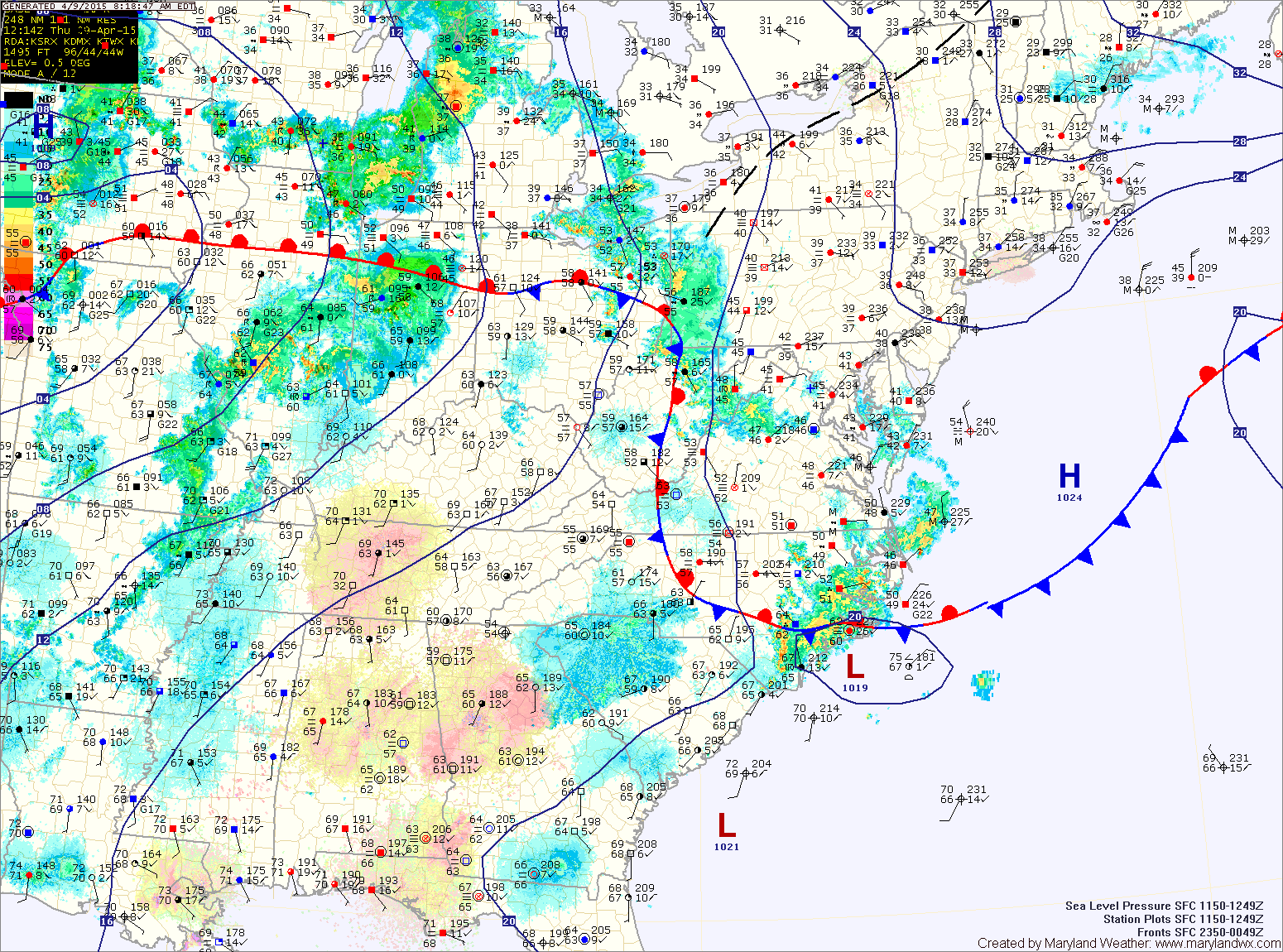
An area of low pressure with a cold front will move into the Great Lakes region tonight and tomorrow, pulling the front back northward as a warm front. This will allow temperatures to warm nicely tomorrow, reaching the mid to upper 70s by tomorrow afternoon.
The cold front will be approaching the area tomorrow afternoon. As temperatures warm ahead of the front, instability will increase as well. As a result, scattered showers and thunderstorms are likely during the afternoon and evening hours.
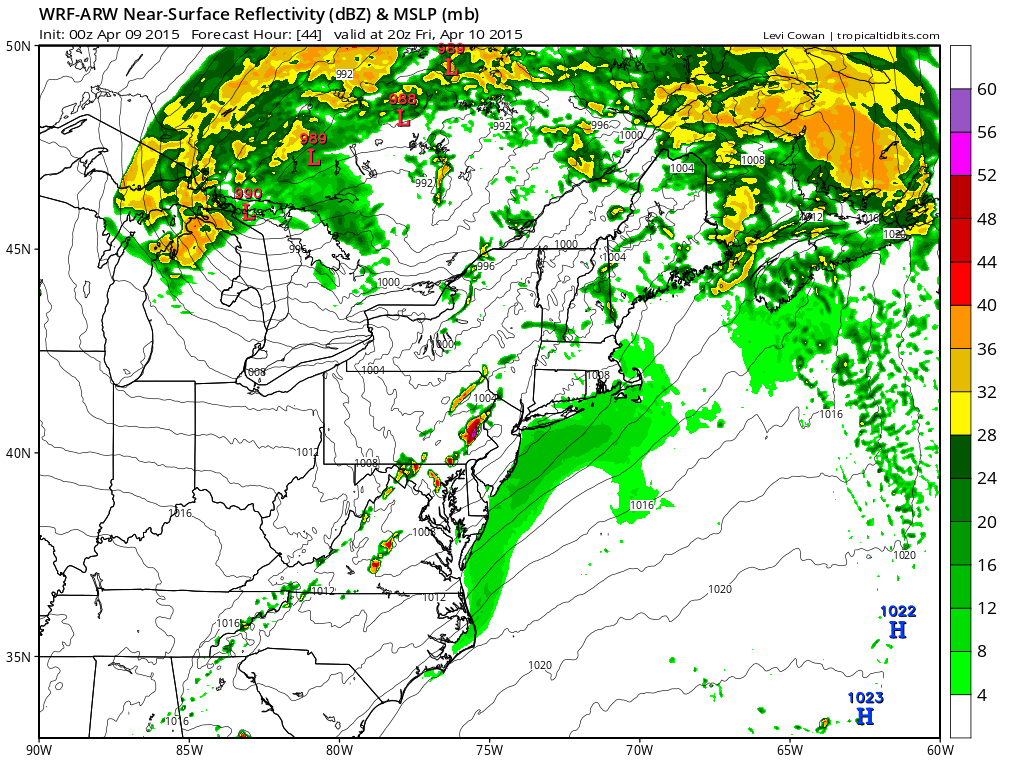
Unfortunately, the best chance for storms will coincide with the Orioles Opening Day game. While a rain out does not appear likely, showers and storms could cause delays should they pass over Baltimore.
The front will clear the state late tomorrow evening and cooler and drier air will begin to filter in.
High pressure will take control this weekend leading to very pleasant conditions. Expect mostly sunny skies both Saturday and Sunday with highs in the mid 60s.
The high will move off of the coast by Monday allowing temperatures to warm back into the 70s. A weak cold front will likely pass through Monday evening with a chance of showers.
Stay up to date with storm information on your favorite social media site!
Follow me on Twitter, Facebook and Google+!