
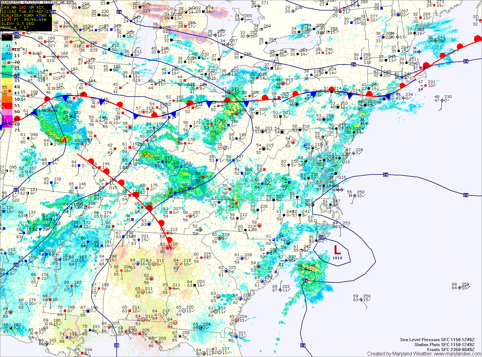
We will remain south of the front today, within the warm sector. As a result temperatures will once again push into the low to mid 70s. Today will be mostly dry, but scattered showers and possible thunderstorms will move through this afternoon and evening.
The front slides south tonight and showers will become more numerous during the overnight. With the front to our south, cooler marine air will push into the state tomorrow. Expect highs to only reach the upper 40s to low 50s with overcast clouds, areas of drizzle and scattered showers through the day.
Expect more of the same on Thursday. Showers will be likely and temperatures may not make it out of the 40s.
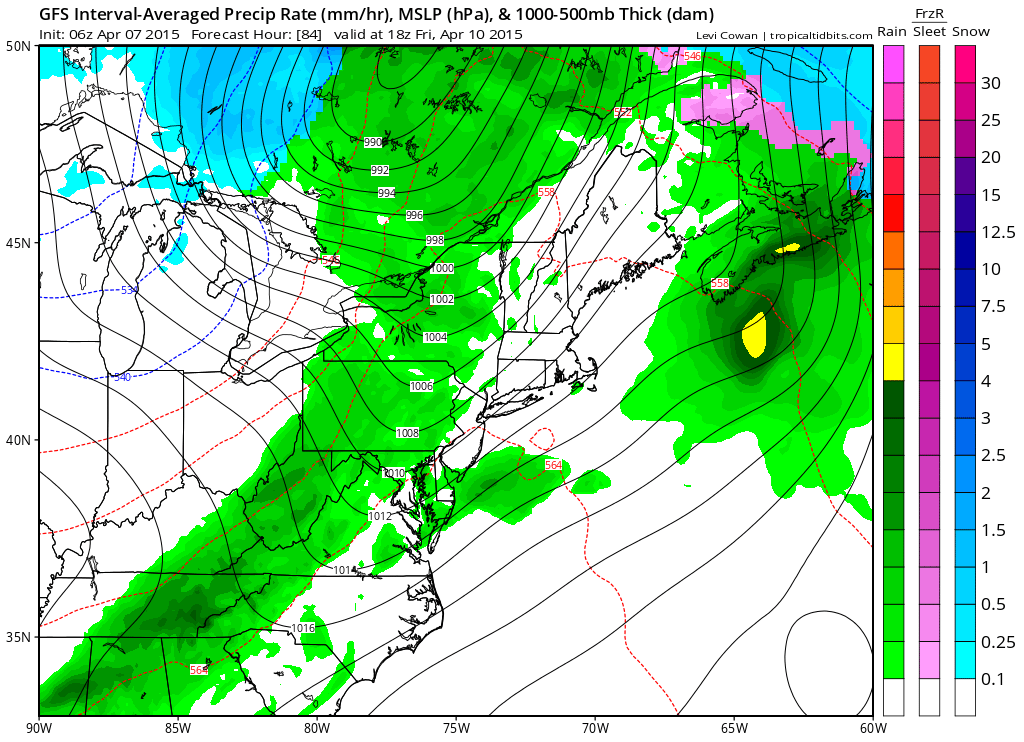
Unfortunately, it looks like rain and storms will likely affect Opening Day for the Orioles as rain remains in the forecast with a clearing cold front approaching from the west.
Showers and thunderstorms are likely Friday afternoon and evening. before the front pushes through Friday night, bringing an end to the rain.
High pressure will build in for the weekend leading to dry conditions and temperatures in the mid to upper 60s.
Stay up to date with storm information on your favorite social media site!
Follow me on Twitter, Facebook and Google+!