
A Winter Weather Advisory has been issued for:
Allegany, Anne Arundel, Baltimore, Baltimore City, Calvert, Caroline, Cecil, Charles, Frederick, Garrett, Harford, Howard, Kent, Montgomery, Prince George’s, St. Mary’s, and Washington counties
A Flood Watch remains in effect for Garrett county
We have two separate events to deal with in the short term, a light wintry mix to rain scenario this afternoon and tonight and then a rain to snow scenario tomorrow night and Thursday.
(click to enlarge)
All in all, this will be a light event and with it starting during the afternoon hours, most roads should remain wet until we begin to lose sunlight this evening. At that time, icy spots may develop making driving more difficult. Temperatures will rise above freezing later tonight, melting any ice accumulation.
That leads us into a Wednesday that will feature rain showers and warmer temperatures. Highs will likely be around 50° by the afternoon.
(click to enlarge)
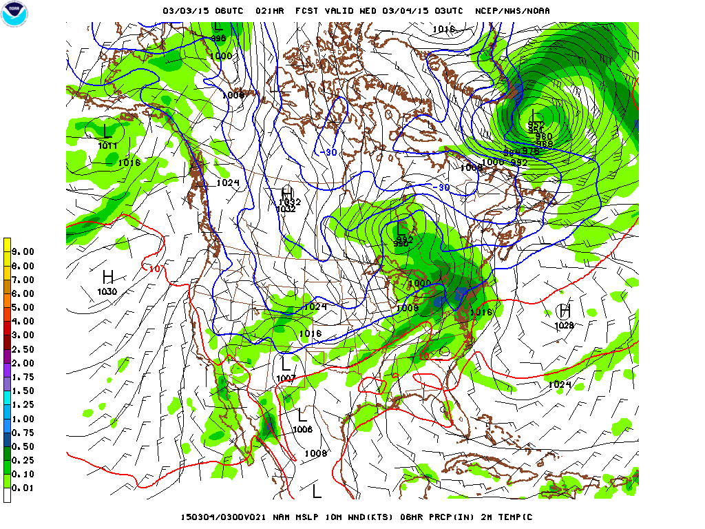
The front will be to our south by Thursday as an area of low pressure slides along it, bringing over-running precipitation to the state. How much snow falls and where is completely dependent on the availability of the cold air.
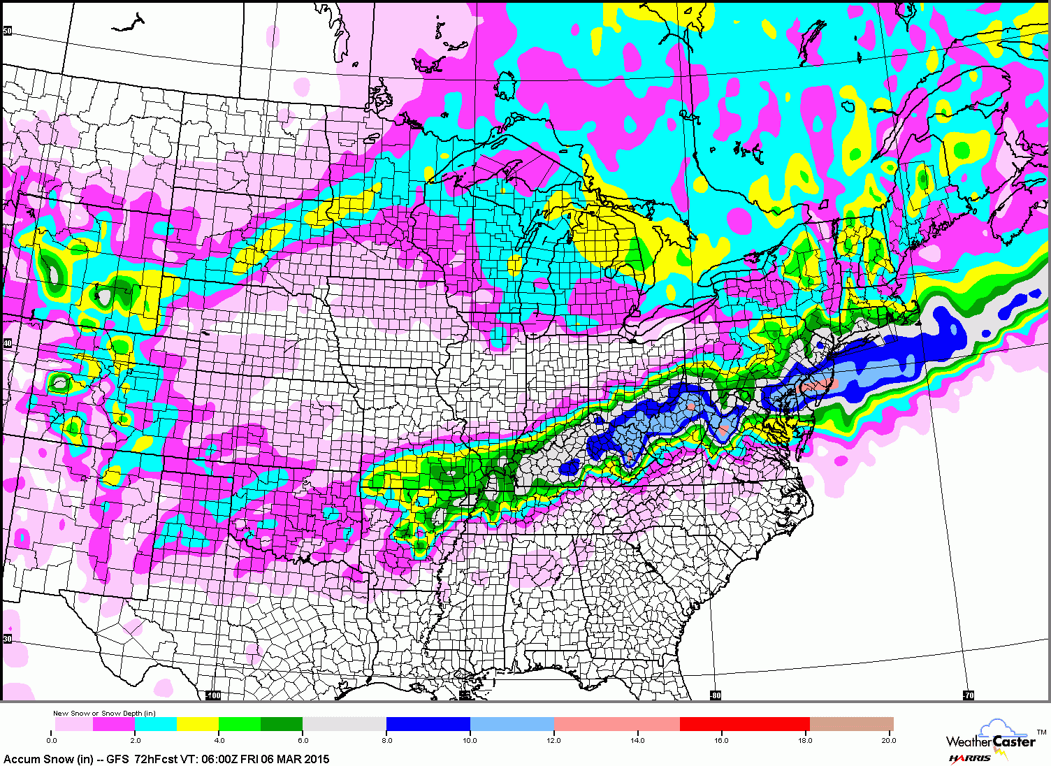
Right now, it appears that the cold air will be in place to support at least a few inches of snow across the state Thursday morning into Thursday afternoon with the potential for more, as shown here by the GFS model.
After reviewing today’s model runs, I will put out a first forecast this evening.
Stay up to date with storm information on your favorite social media site!
Follow me on Twitter, Facebook and Google+!