
A Winter Weather Advisory remains in effect for: Anne Arundel, Baltimore, Baltimore City, Calvert, Caroline, Carroll, Charles, Frederick, Harford, Howard, Kent, Montgomery, Prince George’s, Queen Anne’s, St. Mary’s and Talbot counties
A Winter Storm Warning remains in effect for: Calvert, Charles, Dorchester, Somerset, St. Mary’s, Wicomico and Worcester counties
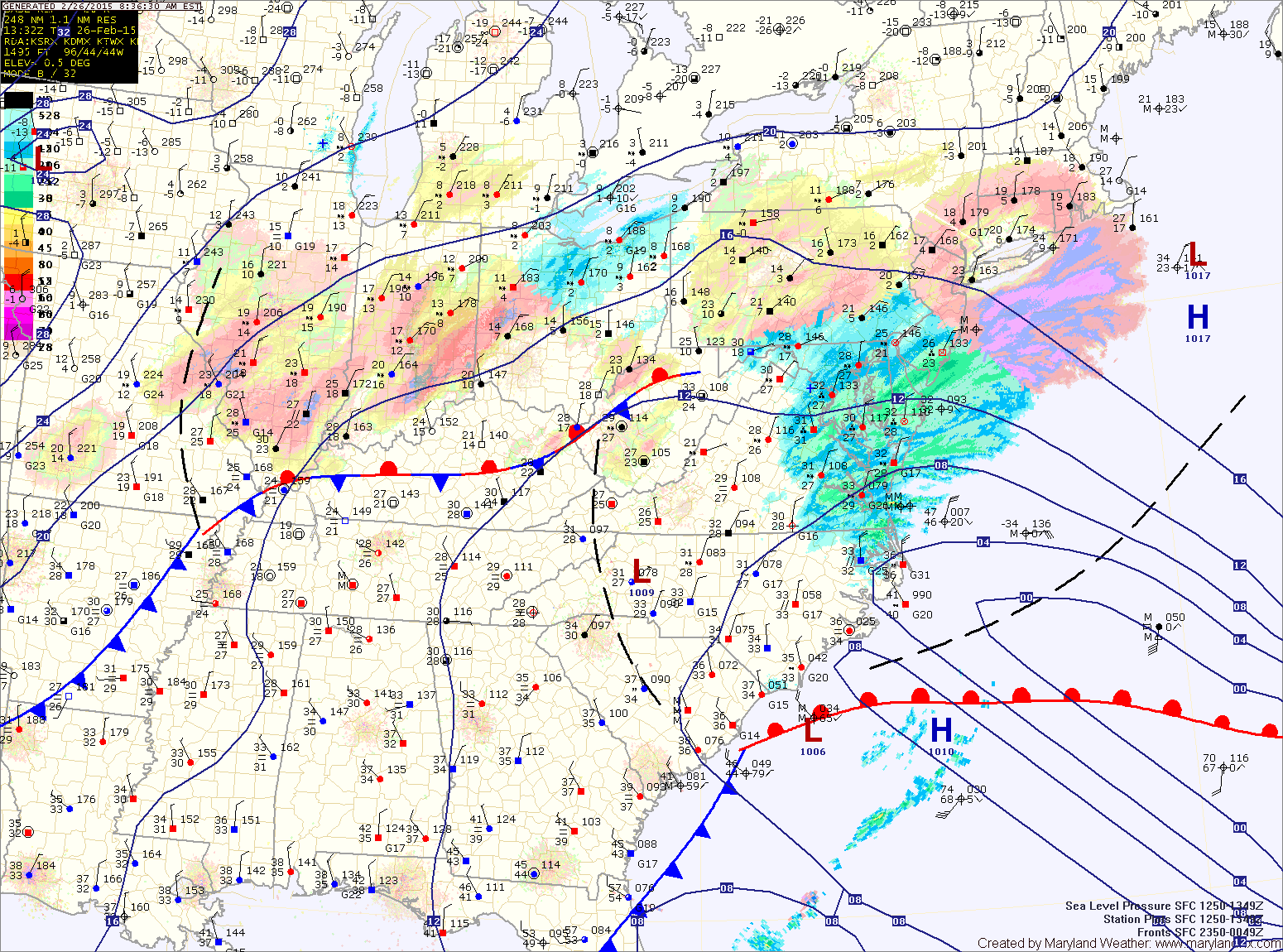
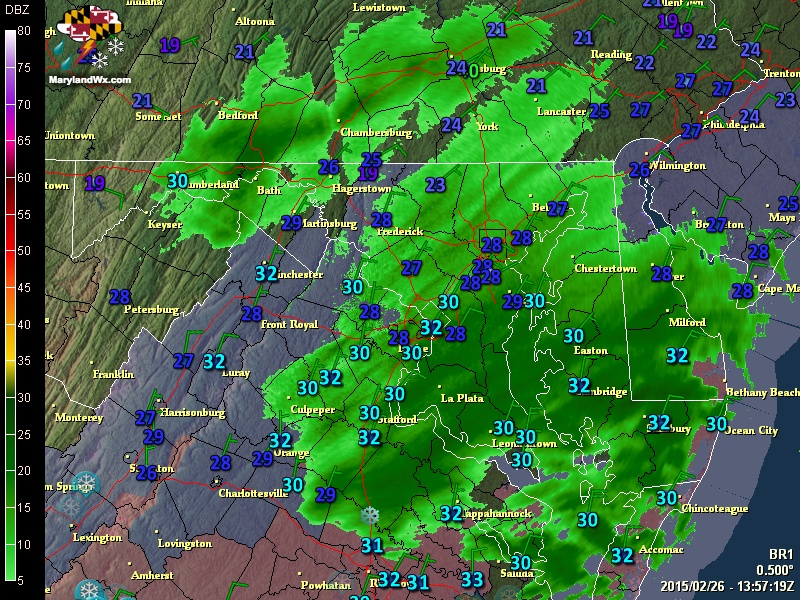
The snow is generally light north and west of I-95 while areas south and east continue to see moderate to heavy bands at times. The snow will continue for another hour or so before tapering off from west to east. An additional 1-3 inches is likely, with the highest amounts across southern Maryland and the lower Eastern Shore.Highs today will top out in the upper 20s to around 30°.
A piece of upper level energy will swing through this evening and tonight and could touch off a few scattered snow showers as it passes through. No accumulation is expected but some slick spots could pop up tomorrow morning. Lows will fall into the upper 10s to low 20s.
Any left over snow showers will end quickly tomorrow morning but it will remain generally cloudy with highs in the upper 20s to around 30.
Skies will clear out Friday night, allowing temperatures to fall down into the low 10s by Saturday morning.
Temperatures will remain well below normal on Saturday, with highs topping out in the upper 20s.
A cold front will approach on Sunday, spreading clouds back into the region during the day. Southerly flow ahead of it should allow temperatures to approach 40° by Sunday afternoon.
Sunday night, the front will approach, spreading precipitation into the area. It may start out as a wintry mix, especially north and west of the cities but it should mainly be a rain event, ending Monday morning.
Another system will move in Tuesday and bring more precipitation into Wednesday with perhaps yet another system affecting us on Thursday.
The good news is that temperatures should be warmer, with highs generally in the 30s and 40s for the majority of the week.
Stay up to date with storm information on your favorite social media site!
Follow me on Twitter, Facebook and Google+!