
Accumulating snow has ended across the state and the storm behaved exactly as expected.
Snow started early this morning from southwest to northeast, affecting the morning commute before tapering off during the late morning hours.
Most areas north and west of I-95 saw an inch or less, with 2-3″ totals common from I-95 through central Maryland. Further south, 3-5″ fell with some places in southern Maryland and the lower Eastern Shore over 6″.
Here is a preliminary map of snowfall reports across the state (updated 1:55pm):
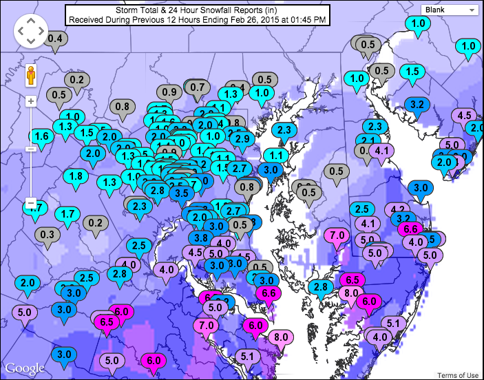
(Click to enlarge)
As the storm continues to pull away, skies will remain generally cloudy with some peaks of sunshine at times through the remainder of the afternoon. Highs will be in the upper 20s to low 30s.
Stay up to date with storm information on your favorite social media site!
Follow me on Twitter, Facebook and Google+!