
A Winter Weather Advisory has been issued for: Dorchester, the Maryland Beaches, Somerset, St. Mary’s, Wicomico and Worcester counties.
A weak cold front will pass through today and high pressure will briefly build in behind it. As a result, expect mostly sunny skies and highs in the upper 30s to around 40.
Meanwhile, an area of low pressure is developing in east Texas and will be moving along the southeast states then up towards our region. The low will slide off the Carolina coast tomorrow, spreading snowfall into the state.
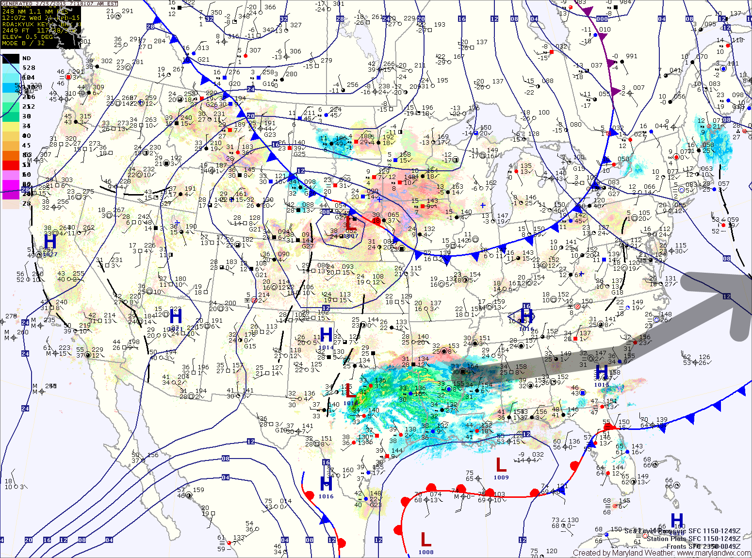
With the low staying well to our south, we will be on the fringe of the precipitation shield. As a result, most areas north and west of I-95 will see very minor, if any accumulation with up to an inch possible east of the mountains and north of DC and Annapolis.
Further south and east, several inches of snow are likely with 1-3″ likely across southern Maryland and up to 3-5″ likely across the lower Eastern Shore.
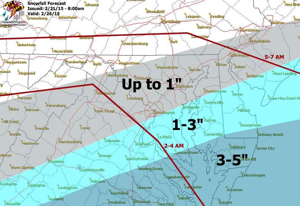
The snow will move into the state before dawn, spreading from southwest to northeast during the early morning hours and affecting the entire state through late morning before ending. Highs on Thursday be around 30°.
There is chance of flurries or snow showers on Friday as a piece of energy pushes through and then high pressure builds in Friday night and Saturday. Saturday will be mostly sunny with highs in the low 30s.
Another system will likely affect the area late Sunday or Monday with a wintry mix to rain scenario. The details of that system will come into focus over the next few days.
Stay up to date with storm information on your favorite social media site!
Follow me on Twitter, Facebook and Google+!