
The snow has stopped and the sun is out across the state as we dig out from what turned out to be a minor to moderate snowstorm. The heaviest of the precipitation stayed south of our state and this contributed to a two fold decrease in our snow totals. First, only light to occasionally moderate snowfall fell during most of the storm and second, due to the lighter precipitation, the very cold dry air cut into the totals as well.
If the precipitation had pushed just a bit further north, my forecast would have verified. I had counted on the cold dry air eating into the totals, which is why I had a sharp drop off of accumulation across the northern part of the state. Conversely, with such cold air, I had counted on higher snow ratios to make up for the lack of moisture.
Below I will compare my forecast to the actual snow totals. As you can see, I had the general idea correct and I wasn’t too far off on the totals across Northern Maryland. Across central Maryland is where I busted badly. Most areas between Baltimore/DC/Annapolis received 4″ or so. I had counted on this area benefiting from the heavier precipitation and higher ratios.
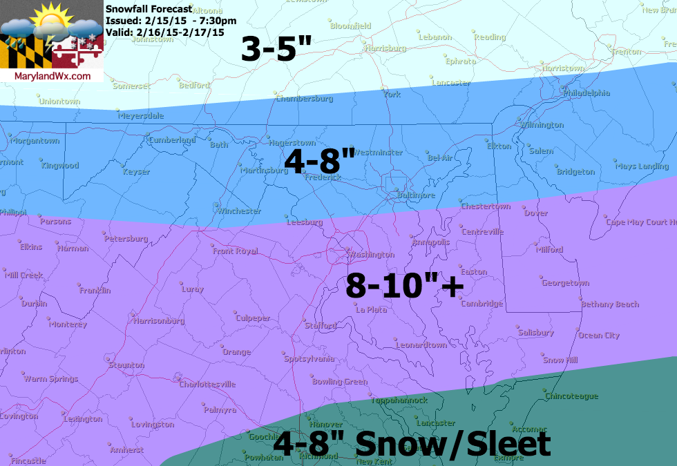
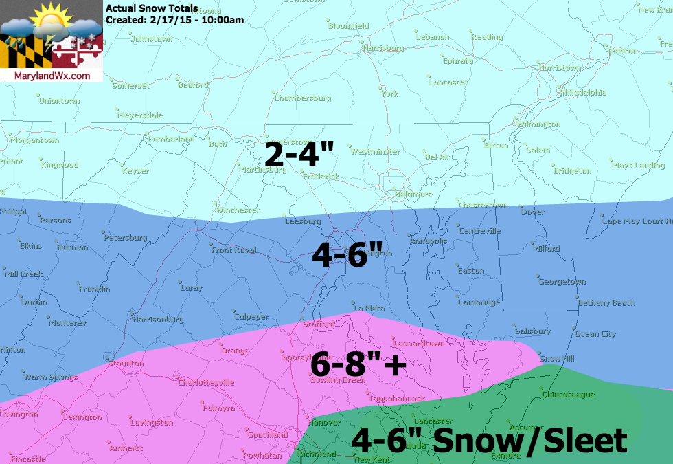
Across southern Maryland, my forecast wasn’t off by much as that area did get into some of the heavier snow, but still not as much as I or many others predicted. Totals of 6-8 were common across southern Calvert, Charles and St. Mary’s counties.
Further south, I was correct in that sleet may mix with the snow and drop totals across the lower Delmarva and the Tidewater of Virginia.
All in all, I’d give my self a C- for this storm since I had the general idea right and was very close in my predictions for northern and southern Maryland. The issue is that where I busted, I busted badly!