
A Winter Weather Advisory has been issued for:
Allegany, Garrett and Washington counties.
A Winter Storm Warning has been issued for:
Anne Arundel, Baltimore, Baltimore City, Calvert, Carroll, Caroline, Cecil, Charles, Dorchester, Frederick, Harford, Howard, Kent, Montgomery, Prince George’s, Queen Anne’s, St. Mary’s, Somerset, Talbot, Wicomico and Worcester counties.
The forecast remains on track for our biggest snowstorm of the season thus far, with snow developing late this afternoon through this evening from southwest to northeast.
Snow will continue tonight and into tomorrow morning before ending sometime around 7am.
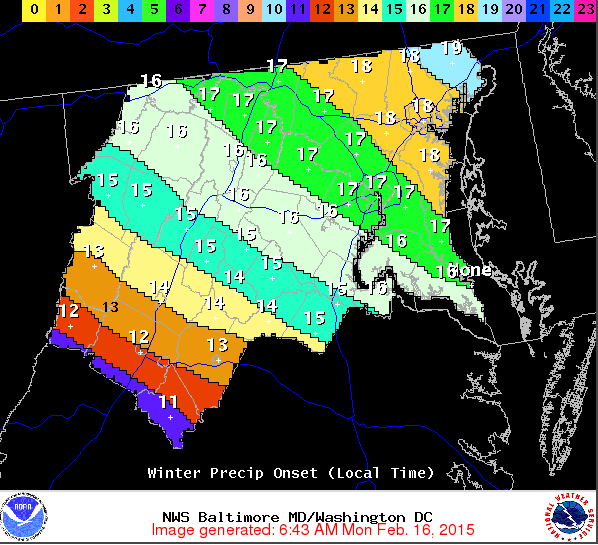
The National Weather Service anticipates the snow will begin entering our state around 4pm and spreading northeastward into the Baltimore/DC metro area between 5 and 6pm and I agree with this timing.
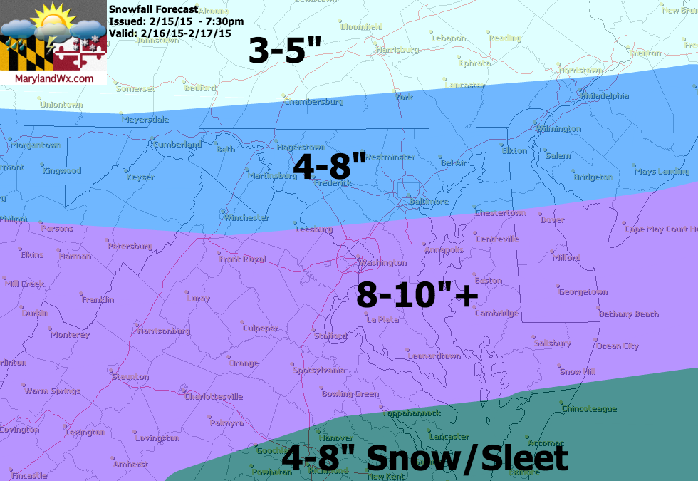
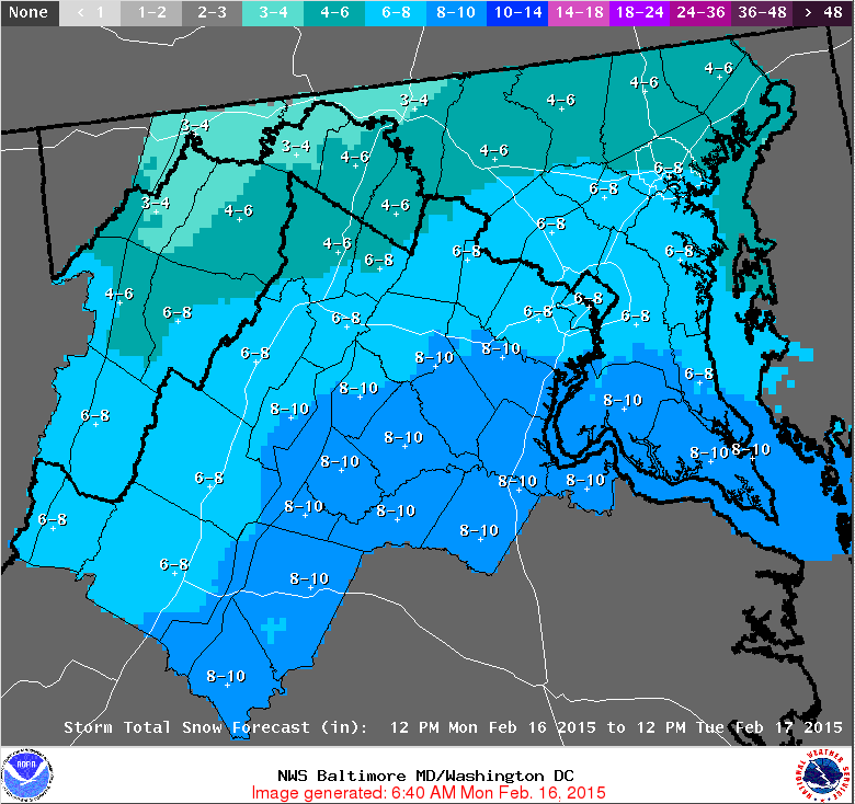
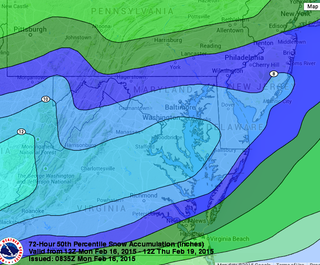
Below is my forecast map as well as the National Weather Service forecast and the Weather Prediction Center’s 50th percentile snow map showing the most likely outcome based on averaging a group of models. As you can see, there is general agreement on snow totals across our area with my map and the WPC map showing slightly higher totals.
Behind the storm a clipper system will push through Wednesday ushering in another shot of very cold air. This cold air will stick around for the remainder of the week and into the weekend. Highs will be in the teens to near 20 Thursday and Friday, and may finally push above freezing by Sunday.