
The arctic air has arrived on the back of strong northwest winds. Those winds have decreased this morning but it remains bitterly cold. Expect highs to only reach the mid 20s today.
A reinforcing cold front will arrive tomorrow and spread light snow through the state tomorrow afternoon into tomorrow night.
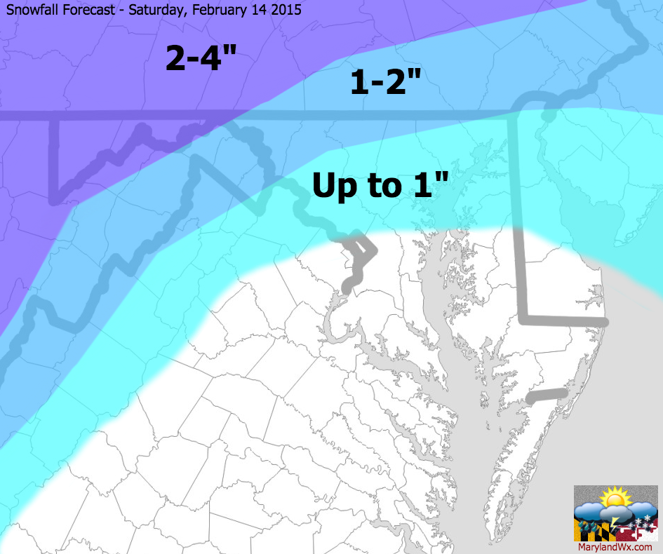 Accumulations will generally be light, but an inch or more is likely, especially north and west.
As that front moves through, low pressure will intensify as it moves into New England where over a foot of new snow can be expected with blizzard conditions. Winds will also increase here and a High Wind Watch has been posted in anticipation of gusts to near 60mph tomorrow night and Sunday.
Highs on Sunday will only reach the mid teens. The cold temperatures combined with the strong winds will make it feel well below zero throughout the day.
With this cold air in place, we turn our attention to a potentially bigger storm system that could affect the area late Tuesday into Wednesday. This system looks as though it will stay south of our area, keeping us on the colder side of the storm. The track of the system will ultimately be determined by this surge of cold air as well as the departing storm that will affect New England this weekend.
Right now, it appears as though the storm will move off of the Carolina coast and then northeastward, potentially giving us our biggest snowstorm of the season thus far. Updates on this system will be posted throughout the weekend.