
A Winter Storm Warning continues for: Allegeny and Washington counties.
A Winter Weather Advisory continues through tomorrow evening for: Anne Arundel, Baltimore, Baltimore City, Calvert, Caroline, Caroll, Cecil, Charles, Dorchester, Frederick, Garrett, Harford, Howard, Kent, Montgomery, Prince George’s, Queen Anne’s, Somerset, St. Mary’s, Talbot, Wicomico and Worcester counties.
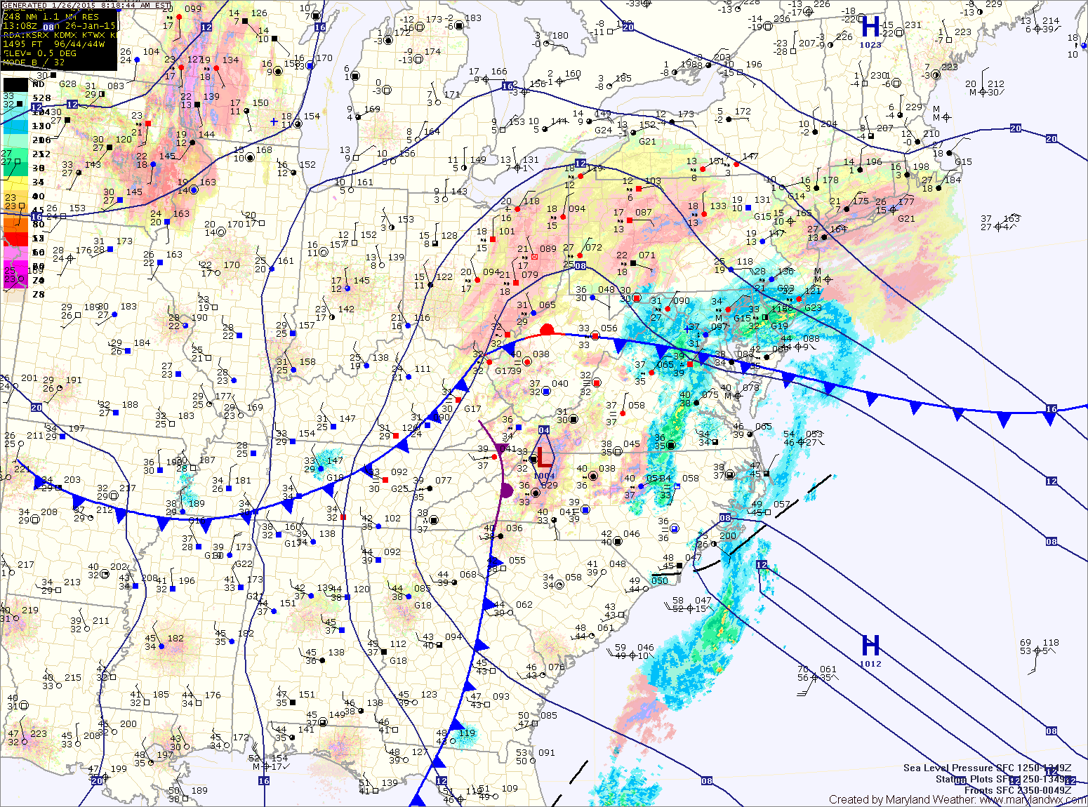
Tonight, the storm will rapidly intensify along the coast and head towards New England where over 2 feet can be expected.
We will be on the fringe of the storm as it moves northeast. Snow will continue, especially along and east of I-95 tonight into tomorrow before tapering off during the late morning or afternoon.
Zone Forecast:
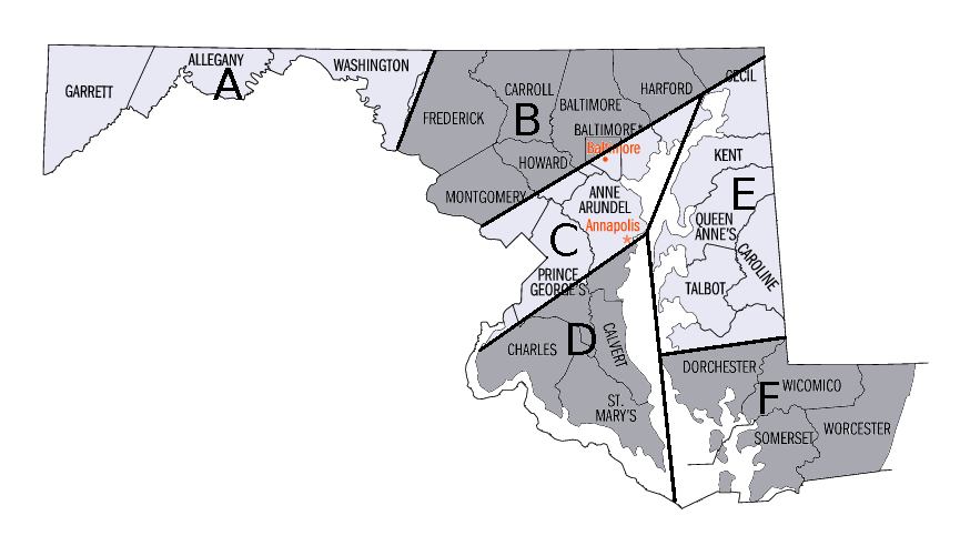
Zone B: Light snow continues today, becoming steadier this evening and tonight before tapering off tomorrow morning. Total accumulations of 3-5″ expected, with most of that occurring this evening and tonight.
Zone C: Light snow continues today, becoming steadier this evening and tonight before tapering off tomorrow morning or early afternoon. Total accumulations of 2-4″ expected, with most of that falling this evening and tonight.
Zone D: Light snow or rain/snow mix continues today, becoming all snow this evening and continuing tonight into tomorrow morning. Total accumulations of 1-3″ expected tonight into tomorrow.
Zone E: Light rain/snow mix continues today, becoming all snow this evening and continuing through tonight into tomorrow before tapering off tomorrow afternoon. Total accumulations of 3-5″ expected tonight into tomorrow.
Zone F: Light rain/snow mix continues today, becoming all snow tonight. The snow will continue into tomorrow morning, tapering off tomorrow afternoon. Total accumulations of 1-3″ expected.
Behind the system, much colder and drier air will flow into the region on strong northwest winds. Lows will be around 20 and highs around freezing each day Tuesday through Thursday.
Another clipper system may bring snow showers to the area Thursday night or Friday, followed by a potentially bigger system for the latter half of the weekend.