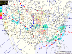
A weak area of low pressure is moving up the coast today. As it does, showers will move into the area this morning. The showers may start as or mix with sleet before changing to all rain during the late morning and early afternoon. Highs today will reach the mid to upper 30s.
The low will continue to move up the coast tonight and tomorrow. Showers will continue tonight, tapering off to drizzle tomorrow. Highs will be in the mid 40s.
A stronger system will bring a cold front into the area Tuesday night into Wednesday. Gulf moisture and warmer temperatures will flow northward ahead of the front allowing to rain to develop late Tuesday night. The rain will continue Wednesday, moderate to heavy at times. Highs will reach the upper 50s to near 60.
The front will push through late Wednesday night or early Thursday, followed by clearing skies and strong northwest winds. Highs will be around 50 with wind gusts to near 25 mph.
High pressure will build in Friday and last into the weekend. As a result, expect mostly sunny skies Friday and Saturday with highs around 50.
Another weak system may bring a slight chance of showers on Sunday.
