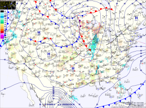
The rain will continue tonight and tomorrow, possibly heavy at times as winds increase as well. Lows tonight will fall into the mid 30s and tomorrow’s highs will be in the low 40s. Winds could gust to 35mph.
The storm will pull away tomorrow afternoon and evening and the rainfall will taper off and become more scattered as we head into tomorrow night.
Scattered showers will be during the day Wednesday and into Wednesday night. It will remain windy, with gusts near 30mph. Highs on Wednesday will be in the low to mid 40s.
Expect a drying trend Thursday and Friday that should last through the weekend. Highs will be in the low 40s Thursday, warming to the mid to upper 40s by Saturday and Sunday.
