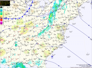
The front will dissipate as it moves into the area tonight and rain chances will taper during the overnight.
Tomorrow will feature increasing clouds as another system moves in from the west. Highs will be in the mid 80s.
The system will push into the area Wednesday night, bringing another round of showers and thunderstorms. These showers and storms will continue into Thursday until the system pushes off the coast during the late afternoon or evening. Highs on Thursday will be in the low 80s.
Behind that system, high pressure builds in and takes control through the weekend. Expect mostly sunny skies Friday and Saturday with highs in the low 80s both days.
As the high moves off the coast, southern flow may provide enough moisture for isolated showers and thunderstorms by Sunday. Highs will be in the low to mid 80s.
A cold front will approach on Monday, increasing the shower and thunderstorm threat.
Yesterday’s Weather Station Stats:
High Temp: 81.3°
Low Temp: 51.7°
Rain: 0.00″
