
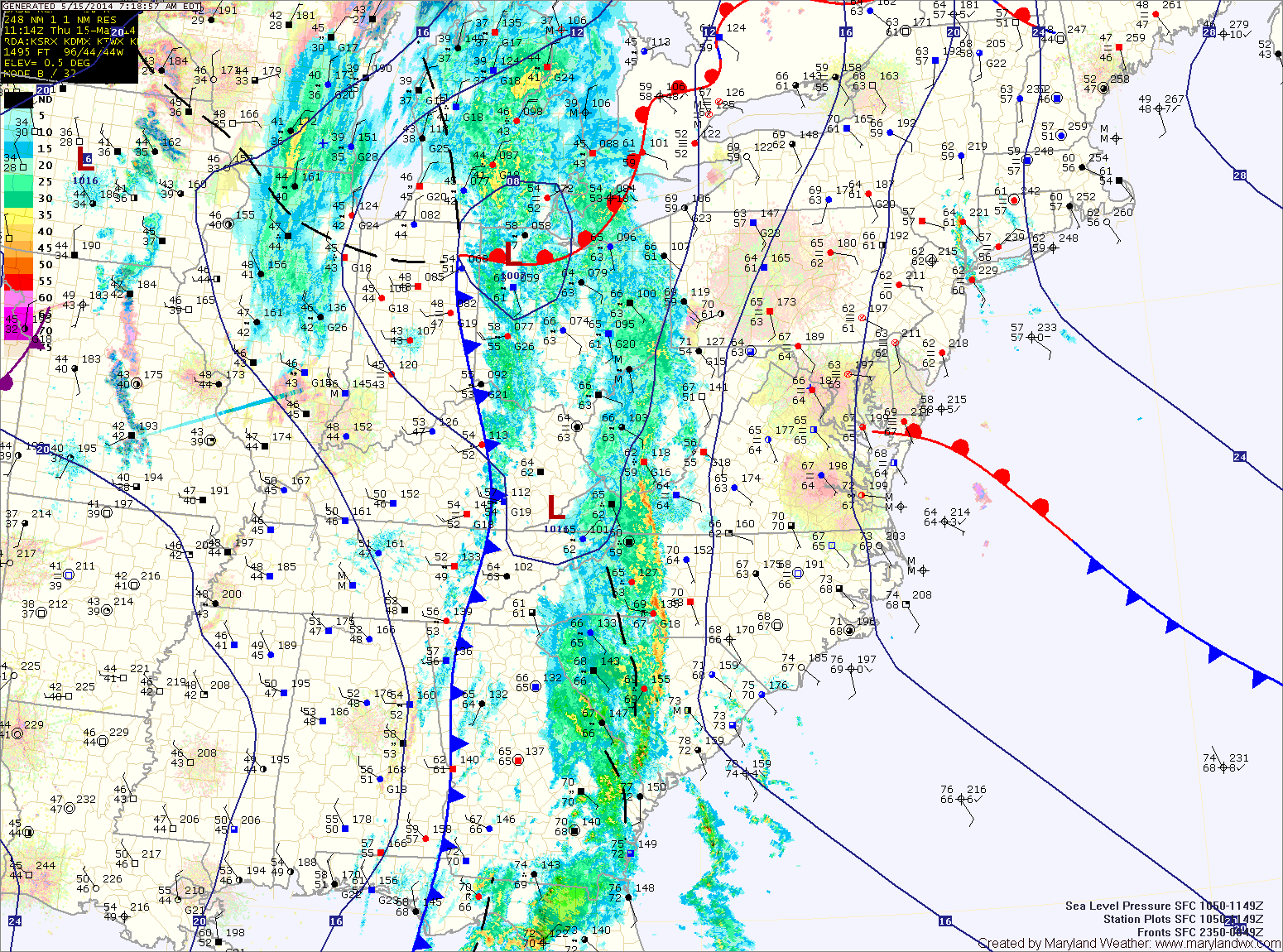
A cold front with ample moisture is slowly moving towards the region today. Ahead of the front, easterly flow has continued, resulting in fog and misty conditions.
As the front approaches, the flow should shift to a more southerly direction and intensify, scouring out the low level moisture. Expect this to occur this afternoon, resulting in breaks in the cloud cover and breezy conditions.
The front will be close enough late this afternoon to trigger scattered showers and thunderstorms before the more widespread rainfall moves in this evening. Highs today will be in the low to mid 70s.
Expect gusty showers and thunderstorms tonight into tomorrow morning. Widespread rainfall totals of 1-2″ are likely as the front crosses. The rainfall should begin to taper off from west to east during the late morning and early afternoon hours. The front will clear the state by tomorrow evening.
Behind the front, high pressure will build in and control the weather through the weekend and into next week. Expect mostly sunny skies on Saturday with highs in the low 70s.
Sunday will also be mostly sunny, with highs around 70.
The first half of next week will continue to be pleasant, with highs around 70 Monday and Tuesday, warming a bit as we move into the middle of the week.
Yesterday’s Weather Station Stats:
High Temp: 66.3°
Low Temp: 57.8°
Rain: 0.01″