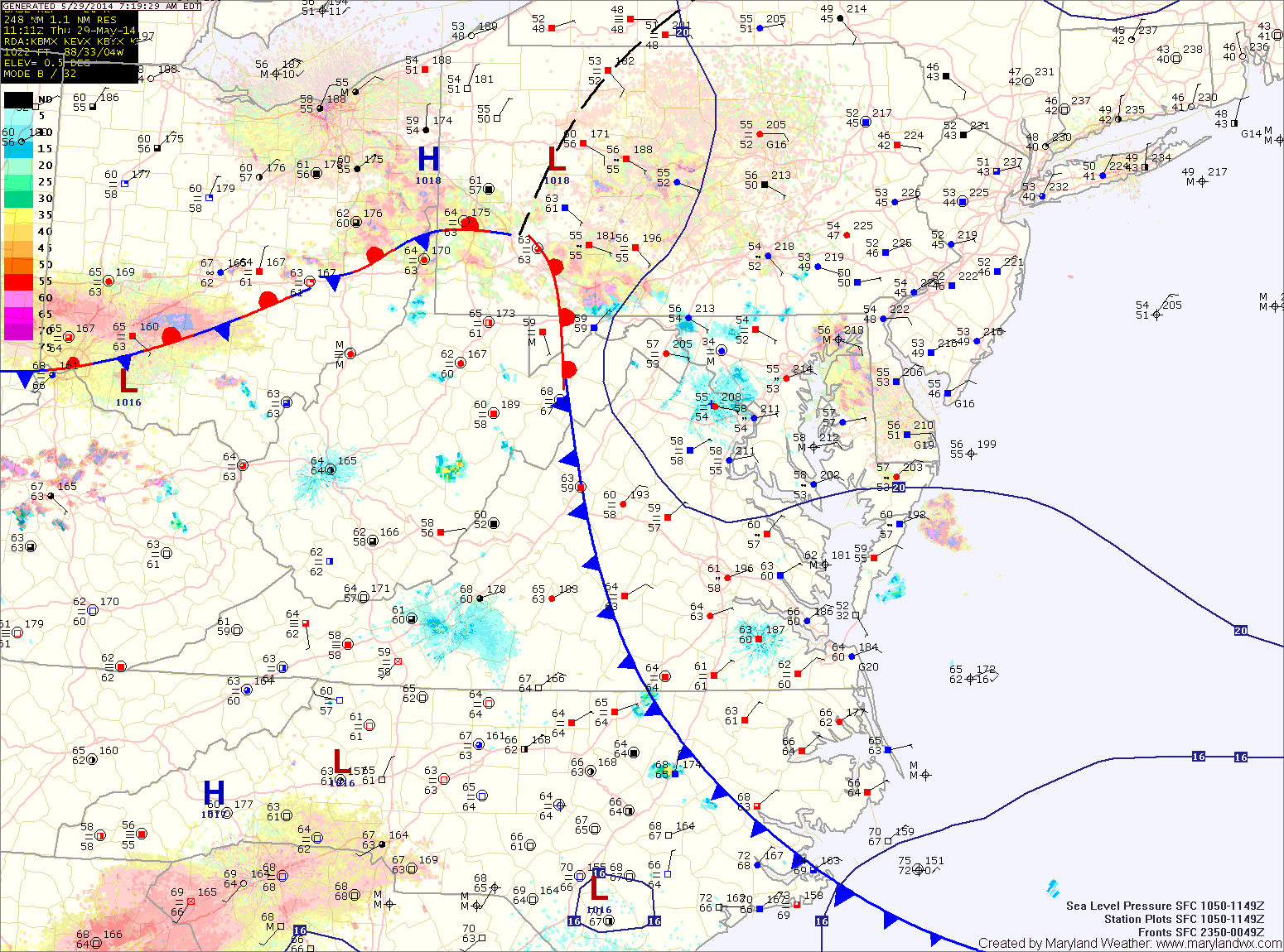
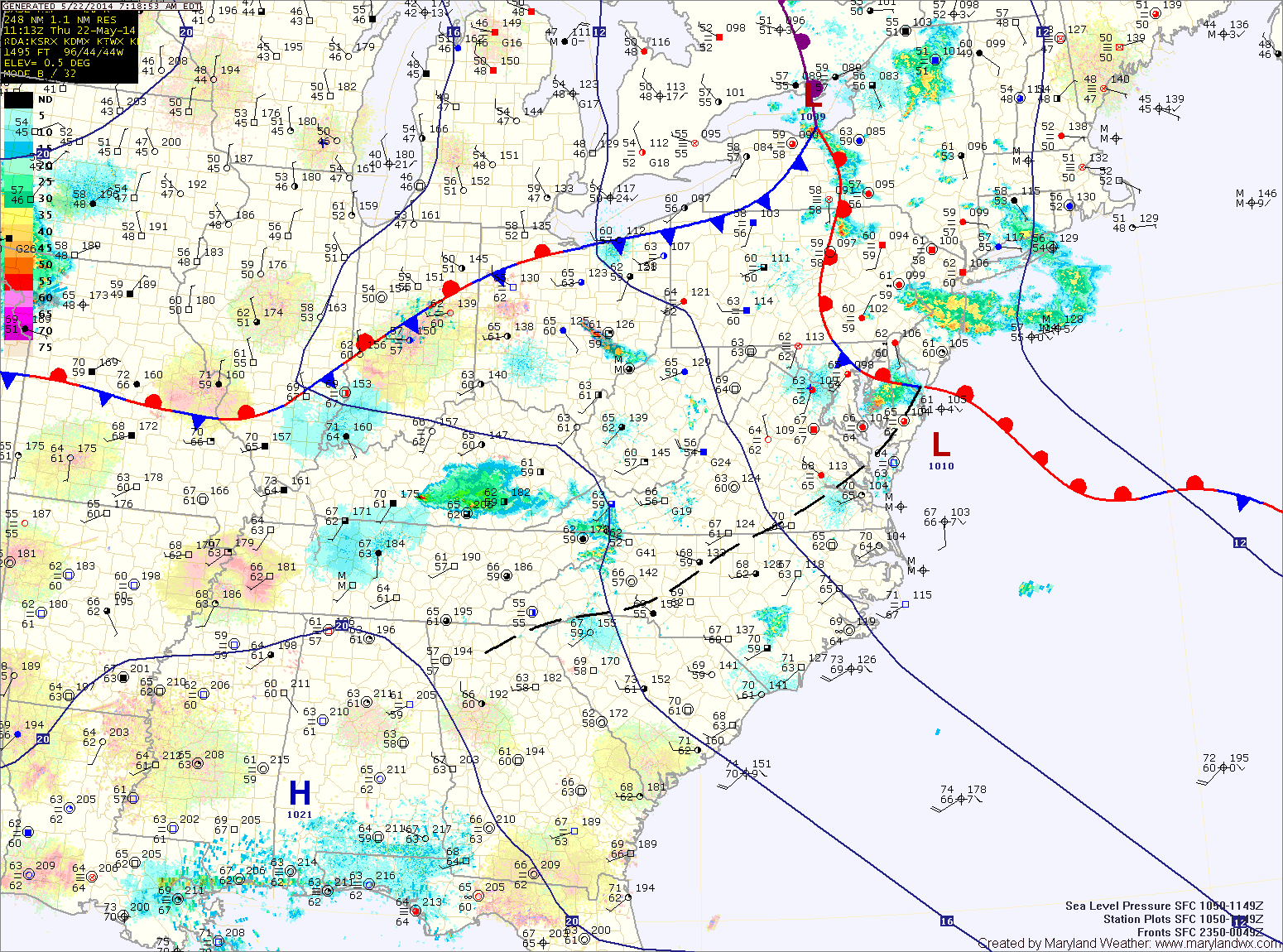
Becoming partly sunny today; Nice weekend on tap

Current Surface Map
Current Surface Map
Easterly flow continues to push marine air into the area this morning. Meanwhile, high pressure is moving in from the west.

The high will shift the flow to the north during the late morning and into the afternoon. This will help to dry out the airmass and will result in a mix of clouds and sun this afternoon. Highs will be in the low 70s.

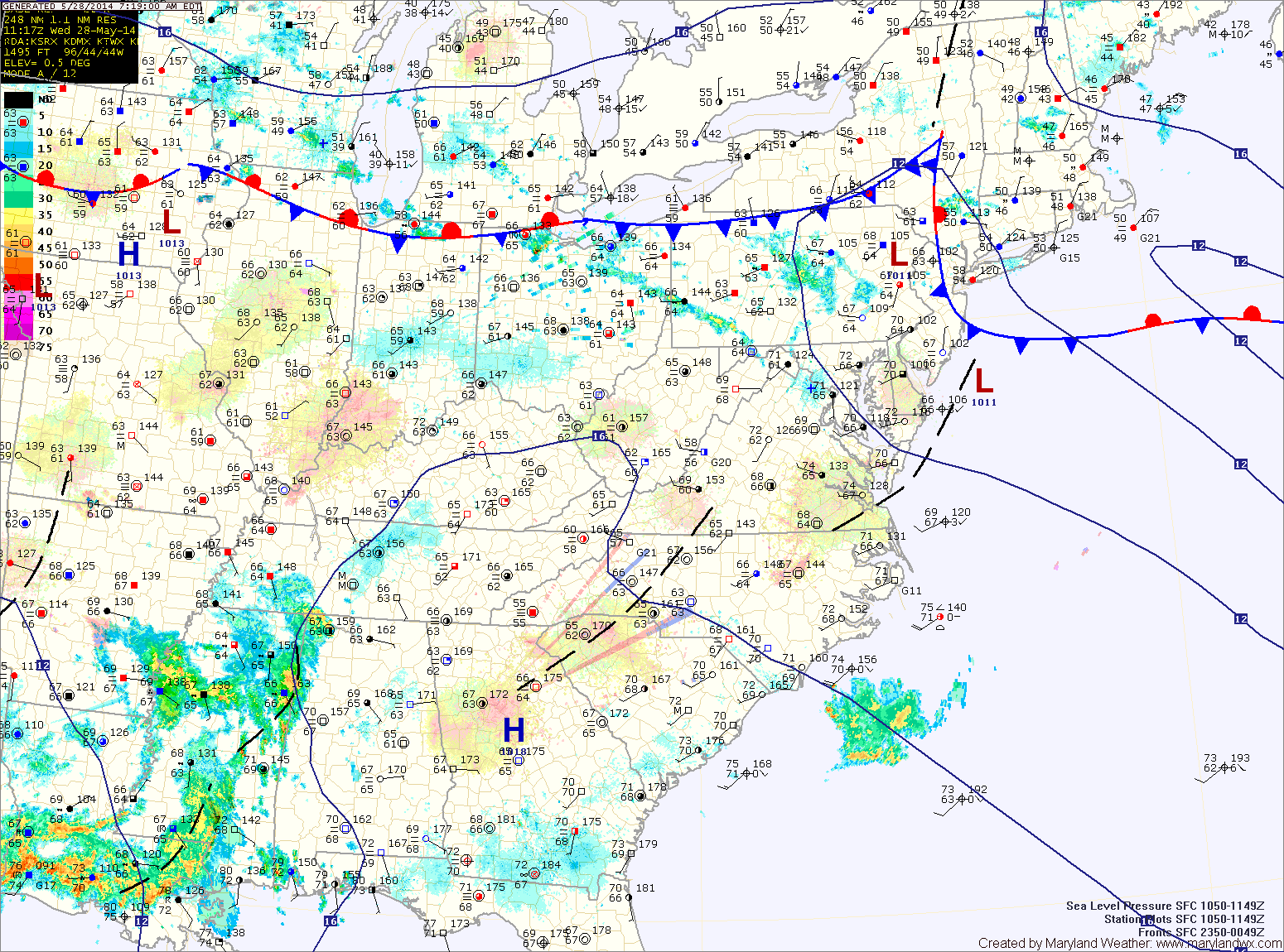
The high will continue to build into the region tomorrow. Expect mostly sunny skies and highs in the upper 70s to low 80s.

Sunday will feature more sunshine, with highs in the mid 70s.

Cloudy and cooler with drizzle and light rain today

Current Surface Map
Current Surface Map
A backdoor cold front has pushed in from the northeast and easterly flow off the Atlantic has brought in cool and moist air. Expect areas of fog, mist and drizzle this morning, continuing through the afternoon. Isolated heavier showers are possible this afternoon as well. Highs will only top out in the low 60s.

Areas of fog will develop tonight as the easterly flow continues.

As we head into tomorrow, high pressure will begin to build in from the northwest. This will scour out the moisture and turn the flow to a more northerly direction. As a result, expect morning clouds to break allowing some afternoon sunshine. There is a slight chance of a shower during the late afternoon, but most areas will remain dry. Highs will be in the low to mid 70s.

Showers and thunderstorms likely today

Current Surface Map
Current Surface Map
A back door cold front will move into the area this afternoon. As it does, showers and thunderstorms will develop this afternoon. Some of the storms may produce damaging winds and large hail. Highs will reach the low to mid 80s.

The front will push through tonight, bringing an end to the thunderstorm threat. However, showers are likely to continue through the night and into tomorrow. As easterly flow develops, the showers will diminish but low clouds and areas of drizzle will remain through most of the day. Highs will only be in the mid 60s.

Skies will try to clear on Friday as high pressure builds in and the flow becomes more westerly. Temperatures will rebound and highs will reach the mid 70s.

Unsettled weather this week; Showers and thunderstorms likely this afternoon

Current Surface Map
Current Surface Map
High pressure off of the south east coast will continue to pump warm and humid air into the region. This will develop showers and thunderstorms across the state today. Some of the storms could become severe, with large hail being the primary threat. Highs today will be in the upper 80s.

A backdoor cold front will approach tomorrow, adding another mechanism for shower and thunderstorm development. Showers and storms are likely tomorrow as well, especially in the afternoon. Highs will be around 80.

The front will push through the state Wednesday night into Thursday morning. Showers will remain likely Thursday morning, tapering off during the afternoon as the front pushes south. It will be much cooler as well, with highs likely topping out in the mid to upper 60s.

Slight chance of a sprinkle today and tomorrow; Sunny Sunday and Monday

Current Surface Map
Current Surface Map
Yesterday’s cold front has pushed off the coast this morning and northwest flow has developed. Skies will start out mostly sunny but an upper level disturbance will move through this afternoon, causing an increase in clouds and possibly a shower as it moves through. Highs today will be in the mid 70s.

Tomorrow will be mostly sunny into the afternoon. There is a slight chance of a late afternoon shower but most areas will remain dry. Highs will be in the mid 70s.

High pressure builds in Saturday night into Sunday resulting in sunshine Sunday and Monday. Highs on Sunday will be around 80 and into the low 80s Monday.

Cold frontal passage today; Showers and thunderstorms possible

Current Surface Map
Current Surface Map
A cold front will move into and through the area today. Ahead of the front, scattered showers and thunderstorms are possible. Some of the storms could be strong to severe, with damaging winds. Highs will be in the low 80s.

The front will clear this evening and northwest flow will develop. The flow will strengthen tomorrow resulting in breezy conditions. Additionally, an upper level disturbance will push through during the afternoon, increasing clouds with an isolated shower also possible. Highs will be in the mid 70s.

Saturday will start out mostly clear, but an afternoon sprinkle is possible. Highs will be in the mid 70s.

Rain likely this morning, mainly north and east; Thunderstorms likely this afternoon and evening

Current Surface Map
Current Surface Map
An area of rain continues to push into the north east portion of the state this morning. This rain is associated with a warm front that is situated near the area. This rainfall will continue to affect the north east counties through this morning.

Additional rainfall is expected this afternoon and evening across most of the state as scattered showers and thunderstorms develop. Some of these storms may become severe, with damaging winds being the greatest threat. Highs today will reach the mid to upper 70s.

A cold front will move into the area tonight and pass through tomorrow. The front will bring another round of scattered thunderstorms tomorrow afternoon. It should clear the state during the evening hours, ending rain chances and bringing in cooler and drier air. Highs tomorrow will be in the low 80s.

Increasing clouds today; Showers and possibly a thunderstorm this evening into tonight

Current Surface Map
Current Surface Map
High pressure will slide off the southeast coast today as a low pressure system moves in from the west. This system will push a warm front through tonight, possibly touching off scattered showers and thunderstorms this evening. Highs will be in the mid 70s.

Scattered showers and thunderstorms remain likely tomorrow, especially in the afternoon and evening as a cold front approaches. Highs will be in the mid to upper 70s.

Rain and thunderstorm chances continue into tomorrow night before tapering off late. By Thursday morning, clouds will begin to decrease slightly. There is a slight chance of a lingering shower or pop-up thunderstorm during the afternoon hours. Highs will be in the low 80s.

Sunny today; Cold front Wednesday

Current Surface Map
Current Surface Map
High pressure will remain overhead today, leading to sunny skies and high temperatures in the low to mid 70s.

The high will slide off the coast tomorrow, allowing southerly flow to develop. This will increase moisture and lead to increasing clouds through the day. Highs will be in the mid 70s.

A cold front will approach tomorrow night and pass through Wednesday night. The front will bring showers and possibly thunderstorms to the region during the day Wednesday. Some of the storms could be severe with damaging winds. Highs will be in the upper 70s to low 80s.

Rain this morning, ending west to east

Current Surface Map
Current Surface Map
A FLASH FLOOD WATCH remains in effect for most counties west of the bay.


A cold front with copious amounts of tropical moisture is pressing through the state this morning. Ahead of and along the front, heavy rain is occurring. The front will continue to push eastward over the next few hours, ending the rainfall from west to east.

Generally, 1-4″ of rain has fallen west of the bay, leading to areas of flooding. Highs this afternoon will be in the upper 60s.

A secondary front will pass through late this evening, bringing another chance of showers as it does.