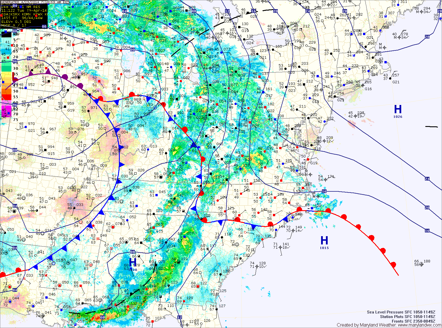
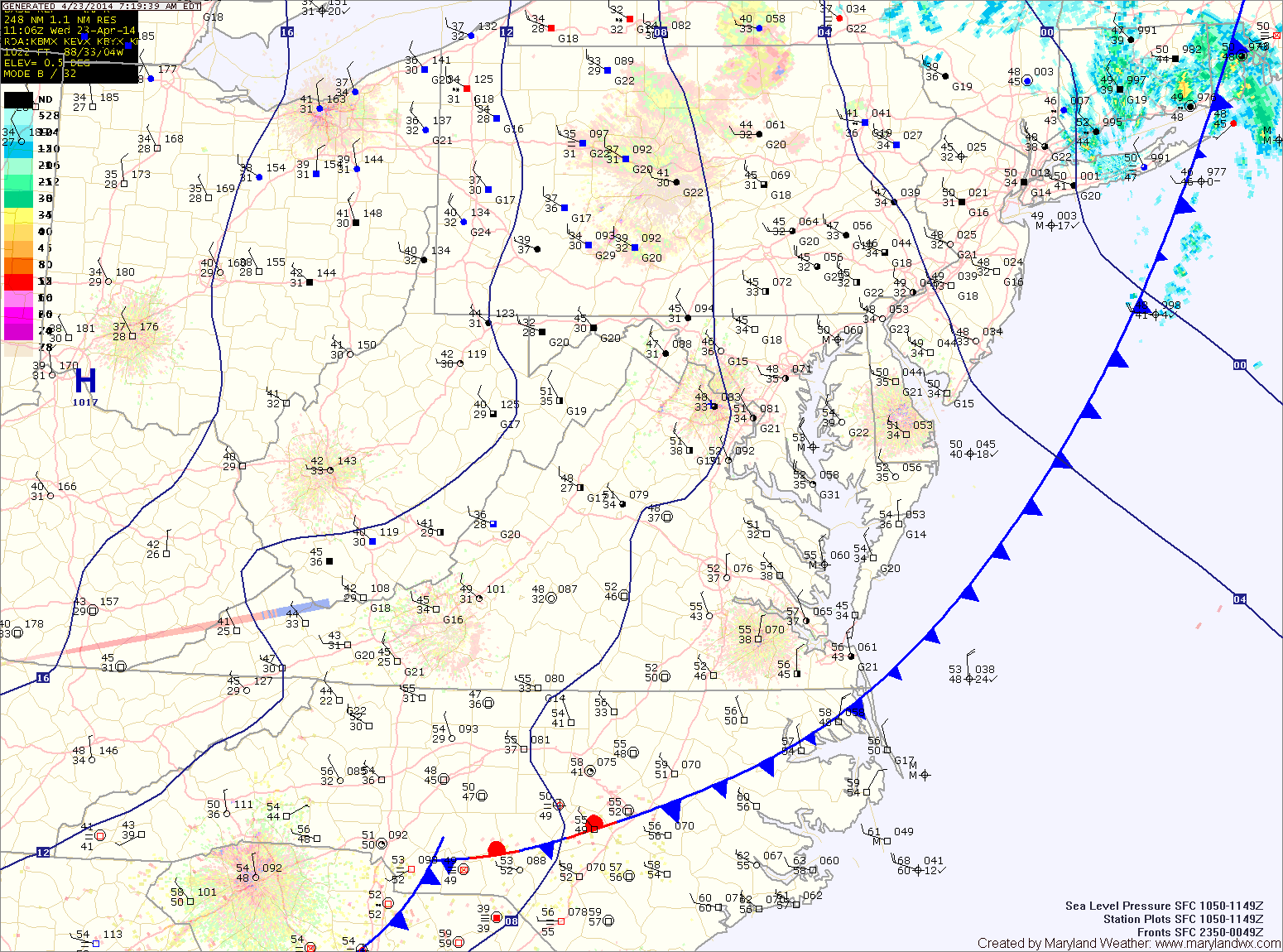
Rain continues today and tonight, heavy at times

Current Surface Map
Current Surface Map
A FLASH FLOOD WATCH remains in effect for all counties west of the bay, except Garrett as well as Kent county.

A FLOOD WARNING is in effect for portions of Anne Arundel, Baltimore, Howard, Montgomery, and Prince George’s counties.

A COASTAL FLOOD WARNING is in effect for Anne Arundel, Baltimore, Calvert, Prince George’s and St. Mary’s counties.

A COASTAL FLOOD ADVISORY is in effect for Caroline, Dorchester, Queen Annes, Somerset, Talbot and Wicomico counties.


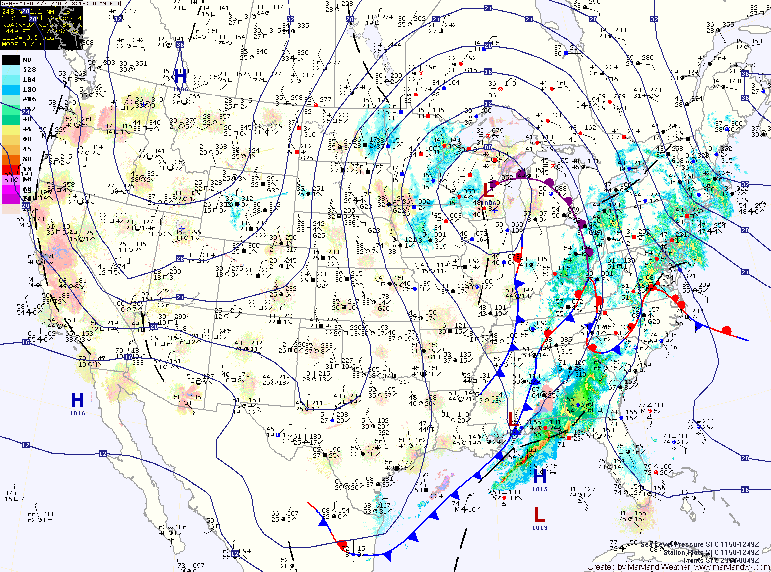
As the area of low pressure that has been slowly moving through the center of the country continues its slow journey northeastward, expect more rainfall and thunderstorms across the area today. The rain will be heavy at times as moisture from the Gulf of Mexico and the Atlantic enhance the rainfall.

The rain will continue through tonight. Thunderstorms will also be possible tonight, especially across southern Maryland. Expect a total 1-2″ of rain today and an additional 1-2″ tonight. Highs today will be in the mid 60s.

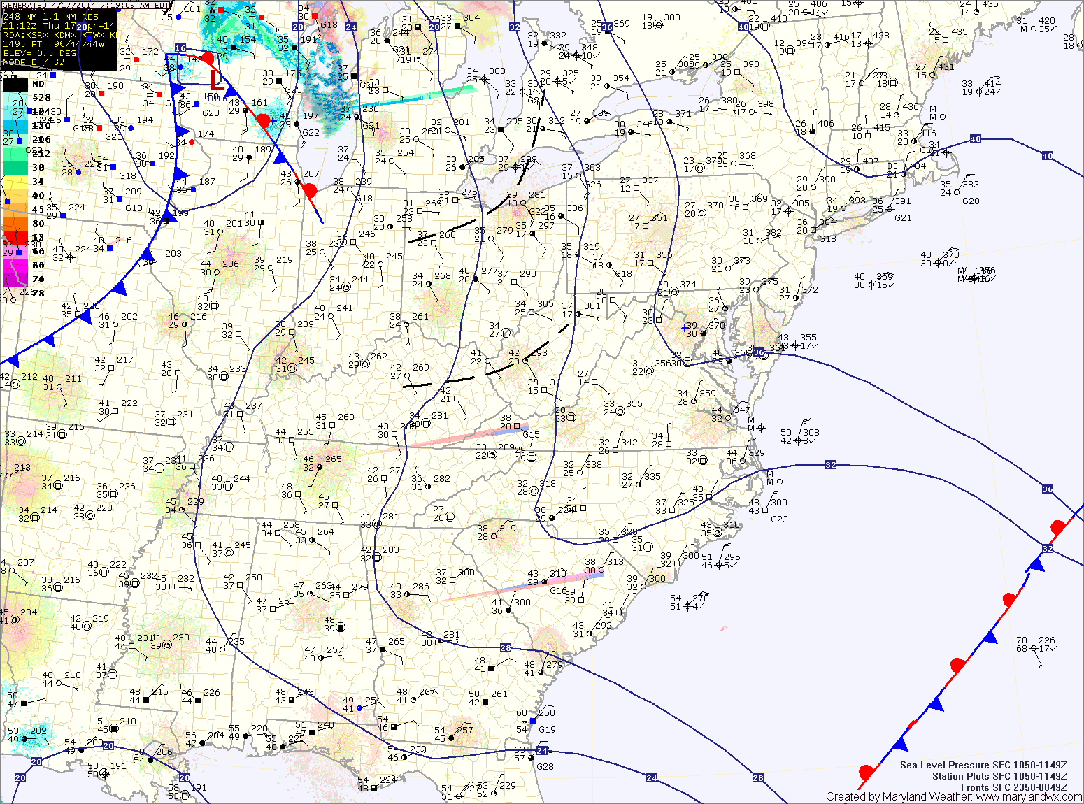
A cold front will cross the area tomorrow morning, slowly bringing an end to the rain. Expect partial clearing during the afternoon and highs in the low 70s.

Rain moves back in today, heavy at times through tomorrow

Current Surface Map
Current Surface Map
A FLASH FLOOD WATCH is in effect this evening through tomorrow night for all counties west of the bay, except Garrett.


A large area of low pressure continues to slowly move through the middle of the country. The low has been responsible for the severe weather and tornadoes across the deep south and will spread another round of rainfall into our area today.

Rain is moving back into the state from west to east. Expect rain to overspread the entire state over the next few hours. The rain will continue through the day. It will also be breezy with highs in the low 50s.

Unsettled week ahead, rain likely through Thursday

Current Surface Map
Current Surface Map
A large area of low pressure over the center of the country will slowly move eastward this week causing breezy conditions as well as bringing several inches of rainfall to the area.

Today will feature increasing clouds with the first round of showers moving in late this afternoon or evening. Highs will be in the low to mid 60s.

Showers will continue tonight and tomorrow, with the rainfall becoming steadier tomorrow afternoon. It will also be breezy, with highs in the low to mid 50s.

Rain will continue tomorrow night and Wednesday, heavy at times. Isolated thunderstorms are also possible Wednesday afternoon. Highs on Wednesday will be in the mid to upper 60s.

Cold front crosses this evening; Rain likely, starting this afternoon

Current Surface Map
Current Surface Map
A cold front will move into the area today, spreading rain out ahead of it. The rain will develop during the afternoon hours and last through the evening. A thunderstorm is also possible this evening. Highs will be in the mid 60s.

The front will clear the state tonight and skies will partially clear heading into tomorrow morning. Another front will sag southward tomorrow with very little moisture. There is a slight chance of an afternoon or evening shower, but otherwise it will be dry and warm with highs in in the low 70s.

Sunday will be mostly sunny with highs in the mid 60s.

Mostly sunny, breezy and warmer today; Rain likely tomorrow

Current Surface Map
Current Surface Map
High pressure will provide mostly sunny skies today and warmer temperatures. It will still be breezy, but highs should reach the mid to upper 60s.

A cold front will approach tomorrow, spreading showers into the region. Showers are likely from mid-morning through the afternoon hours to the west, and from afternoon into evening further east. There is also a slight chance of thunderstorms during the evening hours as the front crosses the state. Highs will be in the upper 60s.

Saturday will be mostly sunny, but a secondary cold front will pass through late in the day or overnight. This front will have little moisture with it, so no rain is expected. Highs will be in the low 70s.

Mostly sunny, breezy and cooler today

Current Surface Map
Current Surface Map
Yesterday’s cold front has pushed off the coast and cooler high pressure is moving in. As a result, expect mostly sunny skies and cooler temperatures. It will also be breezy, with wind gusts to near 35mph. Highs will be in the low 60s.

Tomorrow will also be mostly sunny and breezy, with highs in the mid 60s.

Another cold front will pass through on Friday, bringing another slight chance of showers as it does. Highs will be around 70.

On Saturday, another front will pass through. The front will be mostly dry, with just an increase in clouds expected as it passes. Highs will be in the low 70s.

Cold front passes through today; Showers likely this afternoon

Current Surface Map
Current Surface Map
A cold front will move into the area this afternoon, spreading showers and possibly a thunderstorm through the area. Highs will be in the low to mid 70s.

The rain should come to an end this evening or early tonight as the front clears the state from west to east. Behind the front, northwest winds will turn gusty during the overnight.

Tomorrow will see decreasing clouds, cooler temperatures and strong gusty winds. Highs will be in the low 60s and winds may gust to near 40mph.

Thursday will be mostly sunny, but still breezy. Highs will be in the mid 60s.

There is a slight chance of showers on Friday as another cold front passes through. Highs will be around 70.

Mostly sunny today; Showers tomorrow

Current Surface Map
Current Surface Map
High pressure over the area will continue the stretch of mostly sunny skies today. Highs will be in the mid 60s.

Clouds will increase tomorrow morning as a cold front approaches from the west. Showers and possibly a thunderstorm will move through during the afternoon as the front passes. It will be warmer, with highs in the low to mid 70s.

Behind the front, high pressure once again takes control of the weather on Wednesday. It will be windy, and highs will be in the low 60s.

Winds will decrease on Thursday and highs will be in the mid 60s under mostly sunny skies.

Quiet end to the week; Rain chances decrease Saturday

Current Surface Map
Current Surface Map
After another cold start, today will feature increasing clouds and highs in the mid 50s.

Tomorrow will be a cloudy day but warmer, with highs in the upper 50s to around 60.

An area of low pressure may approach from the south on Saturday, but at this time, it appears it will slide off the coast before impacting the area with anything more than clouds. Highs will be in the mid 60s.

Sunday will be mostly sunny with highs in the mid 60s.