
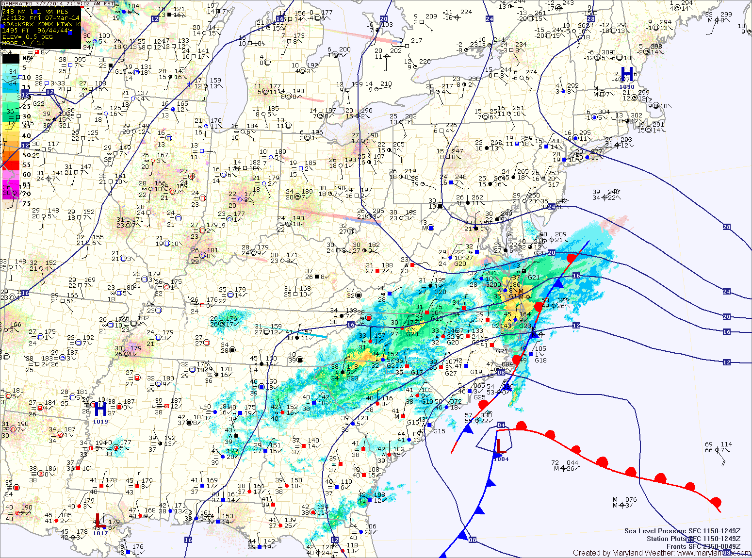
An area of low pressure is moving northeastward off the Carolina coast. The storm will stay well to our south but the northern fringe may spread some light precipitation into the southern and eastern portions of the state.
At the onset, it will be cold enough for any precip that falls to fall in the form of sleet or freezing rain. Temperatures will climb above freezing later this morning, turning any remaining precip over to plain rain. Light showers may persist through the afternoon and into tonight.
Highs today will be around 40 under cloudy skies.
High pressure builds in tomorrow, leading to a pleasant day, with partly sunny skies and highs in the mid 50s.
A weak cold front will pass through tomorrow night, bringing a slight chance of showers as it does. The front will clear the area by Sunday morning.
Sunday will be a mostly sunny day with highs in the upper 40s.
Next week starts dry and warm, with highs on Monday in the mid 50s, warming to the 60s on Tuesday.
Another cold front will move into the region Tuesday night and an area of low pressure will likely form along it, affecting the area Wednesday and Thursday.
The New Zone Map
In an attempt to simplify and clarify forecasts for snowstorms or any other major event, especially those that will cause a variety of weather across the state, we are moving to a zone-based forecast.
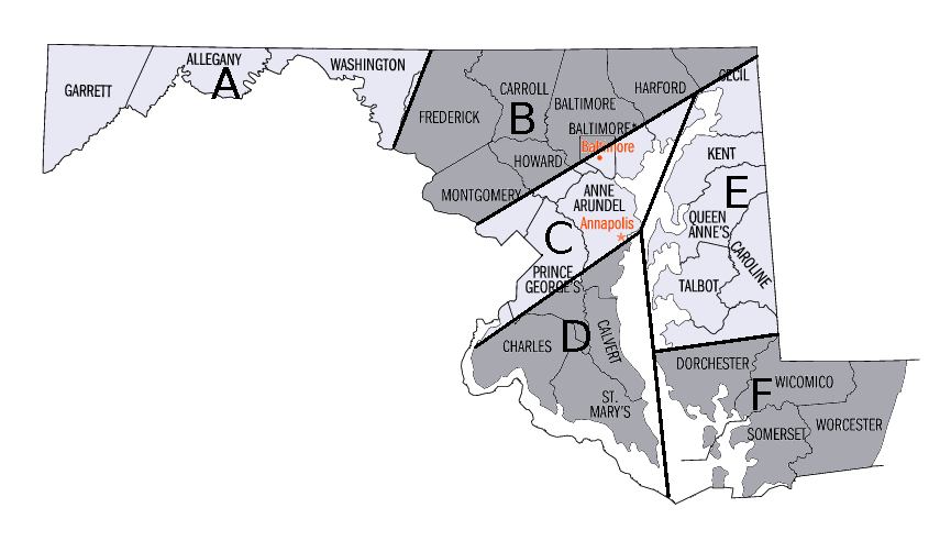
We have split the state into 6 zones:
Zone A: Western Maryland
Zone B: Northern Maryland
Zone C: Central Maryland
Zone D: Southern Maryland
Zone E: Eastern Shore
Zone F: Lower Eastern Shore
We will use these zones when needed, to describe which areas will be impacted by weather events.
For example, here is today’s forecast, formatted to use the new zone system:
An area of low pressure moving off the Carolina coast will spread precipitation into the central and eastern portions of the state.
Expect light sleet or freezing rain to develop this morning, mainly in Zone D. Further east, Zones E and F will see plain rain. All areas will turn over to plain rain by this afternoon.
Further north and west, Zones A, B and C should remain dry.
We hope this new zone forecast helps clarify and depict our forecast especially during winter storms. No longer will you need to figure out if you live in “Northern Maryland” or “Central Maryland”. Now it is defined for you!
Yesterday’s Weather Station Stats:
High Temp: 33.4°
Low Temp: 22.7°
Rain: 0.00″