
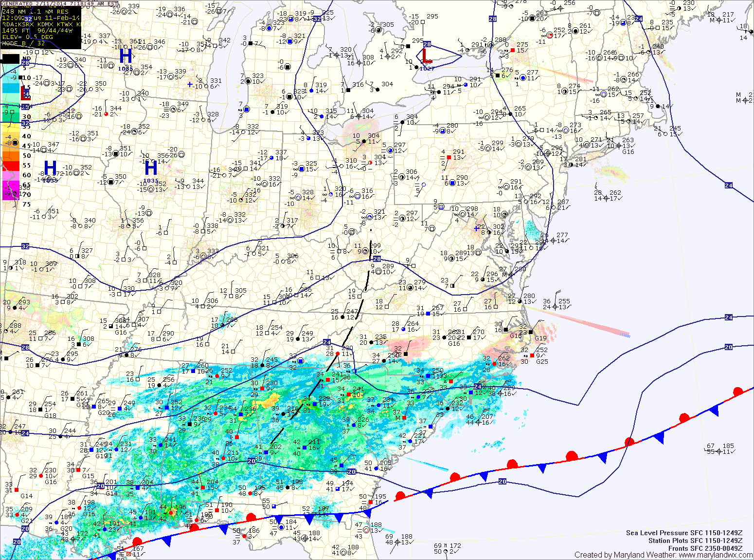
High pressure continues to control our weather, keeping things calm and clear through today. Afternoon highs will top out in the upper 20s.
An area of low pressure is expected to develop over the Gulf states today and move towards the coast tonight. The storm will then move northeastward along the coast, developing into a major nor’easter.
Expect snow to develop from south to north late tomorrow night into early Thursday morning. The snow will be heavy at times through Thursday afternoon before winding down Thursday evening.
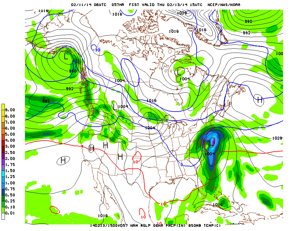
The exact track will determine where the heaviest snowfall occurs and where the snow changes to sleet or rain. As of right now, it appears the models are converging on a scenario that would bring mostly snow to areas west of the bay.
Counties along the western shore of the bay may mix with sleet at times, while a mix or changeover is more likely across southern Maryland and on the eastern shore.
Current snowfall projections:
North and west of I-95: 12-15″
Between I-95 and the bay: 8-12″
Southern Maryland: 4-8″
Eastern Shore: 4-8″
Lower Eastern Shore: 2-4″ then rain
Again, these totals are highly dependent on the exact storm track and could change between now and tomorrow. I will update the forecast tonight if needed and again tomorrow morning. Intermediate updates will be posted to Twitter and Facebook.
Behind the system, a weak clipper system may bring clouds and a few flurries on Friday and another may bring flurries on Sunday. Highs will be in the 30s through the weekend.
Yesterday’s Weather Station Stats:
High Temp: 30.0°
Low Temp: 18.4°
Rain: 0.01″ (snow melt)