
A Winter Storm Warning remains in effect for areas north and west of I-95.
A Freezing Rain Advisory remains in effect for areas south and east of I-95.
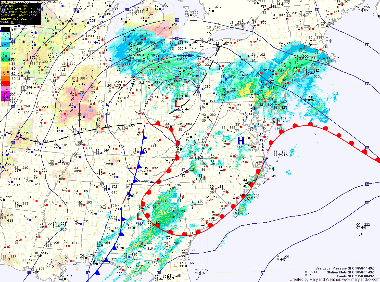
A storm system to our west continues to move towards the northeast. All areas are now seeing freezing rain or plain rain depending on location. Generally, areas to the south and east of Baltimore and Washington are climbing above freezing at this time while north and west remain below freezing and will remain below freezing for a few more hours.
It is in these areas that the Winter Storm Warning is in effect. Up to 1/3 inch of ice can be expected before the rain tapers off this afternoon.
The rain/freezing rain should end by early afternoon for all areas as the storm continues to move away from the area. Highs today will climb to around 40 degrees.
Thursday and Friday will be calm, with partly sunny skies and highs in the mid 30s.
The next storm system that looks to affect the area will move in Saturday into Sunday. Recent model trends have backed off of the idea of a larger coastal system and instead show a weaker low that moves by to our south and out to sea off the Carolina coast. This is due to the fact that they no longer phase the northern stream energy with the southern stream energy. The two separate pieces never connect so the storm stays weaker and does not come up the coast.
This of course, could change again and will be monitored over the next few days but at this time, the weekend system does not seem to be a major storm.
Behind that storm, a stretch of tranquil weather is expected for the majority of next week.
Yesterday’s Weather Station Stats:
High Temp: 35.8°
Low Temp: 25.7°
Rain: 0.02″