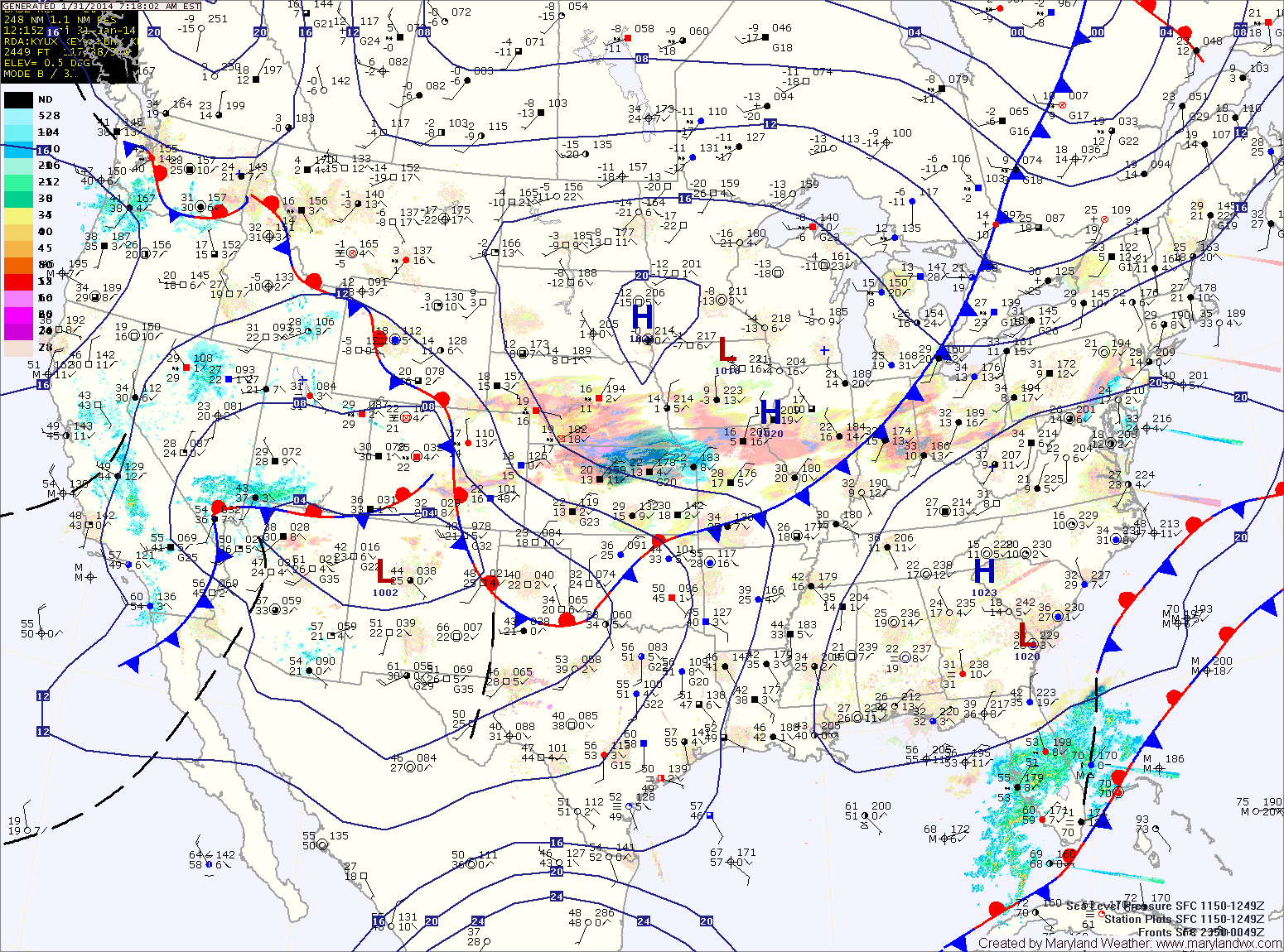
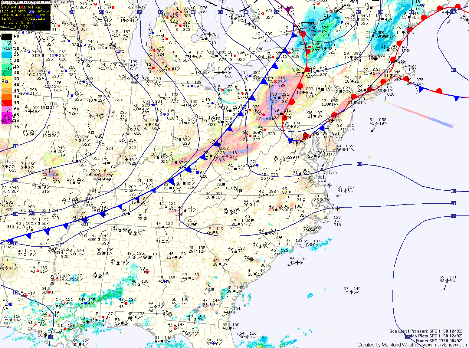
Current Surface MapHigh pressure off the southeast coast will allow warmer air to continue to move into the region today and this weekend. Highs today will be in the mid 40s under partly sunny skies.
Tomorrow will be a few degrees warmer, with highs in the mid to upper 40s under partly sunny skies.
A cold front will move into the area Sunday into Sunday night. There is a slight chance of showers during the afternoon and evening hours as it moves through. Highs on Sunday will be around 50.
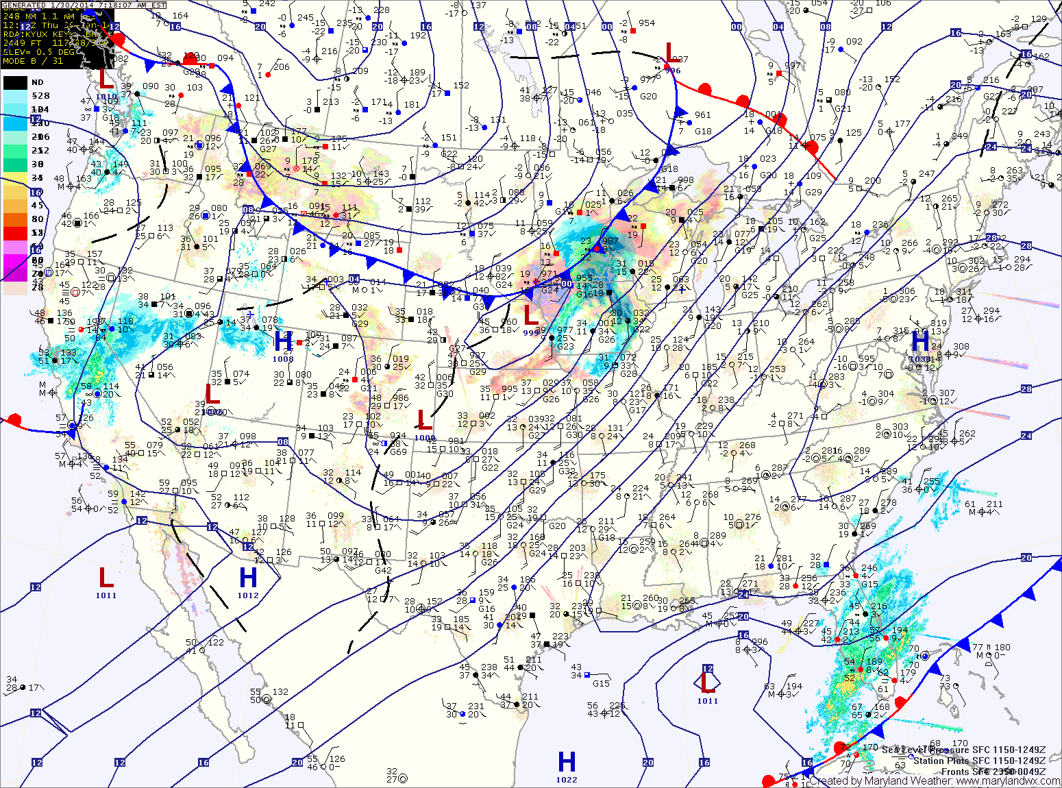
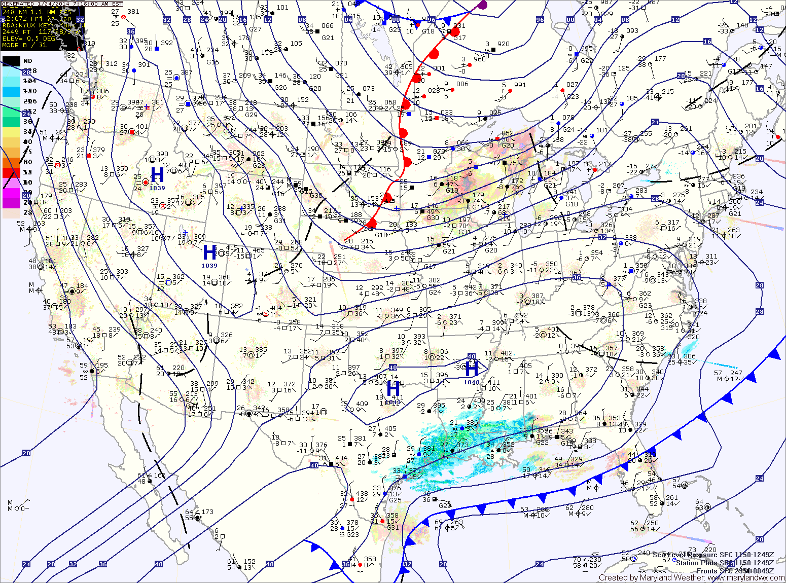
Current Surface MapHigh pressure overhead will slide off the coast today. As it does, southerly flow will develop bringing in warmer air to end the week and into the weekend.
Today will be mostly sunny with highs around 30.
Tomorrow will be partly sunny with highs in the low to mid 40s.
Saturday will feature more clouds than sun as a cold front approaches from the west. Highs will be in the mid 40s.
Sunday will be even warmer, with highs in the upper 40s. There is a slight chance of showers as the front pushes through Sunday afternoon and evening.
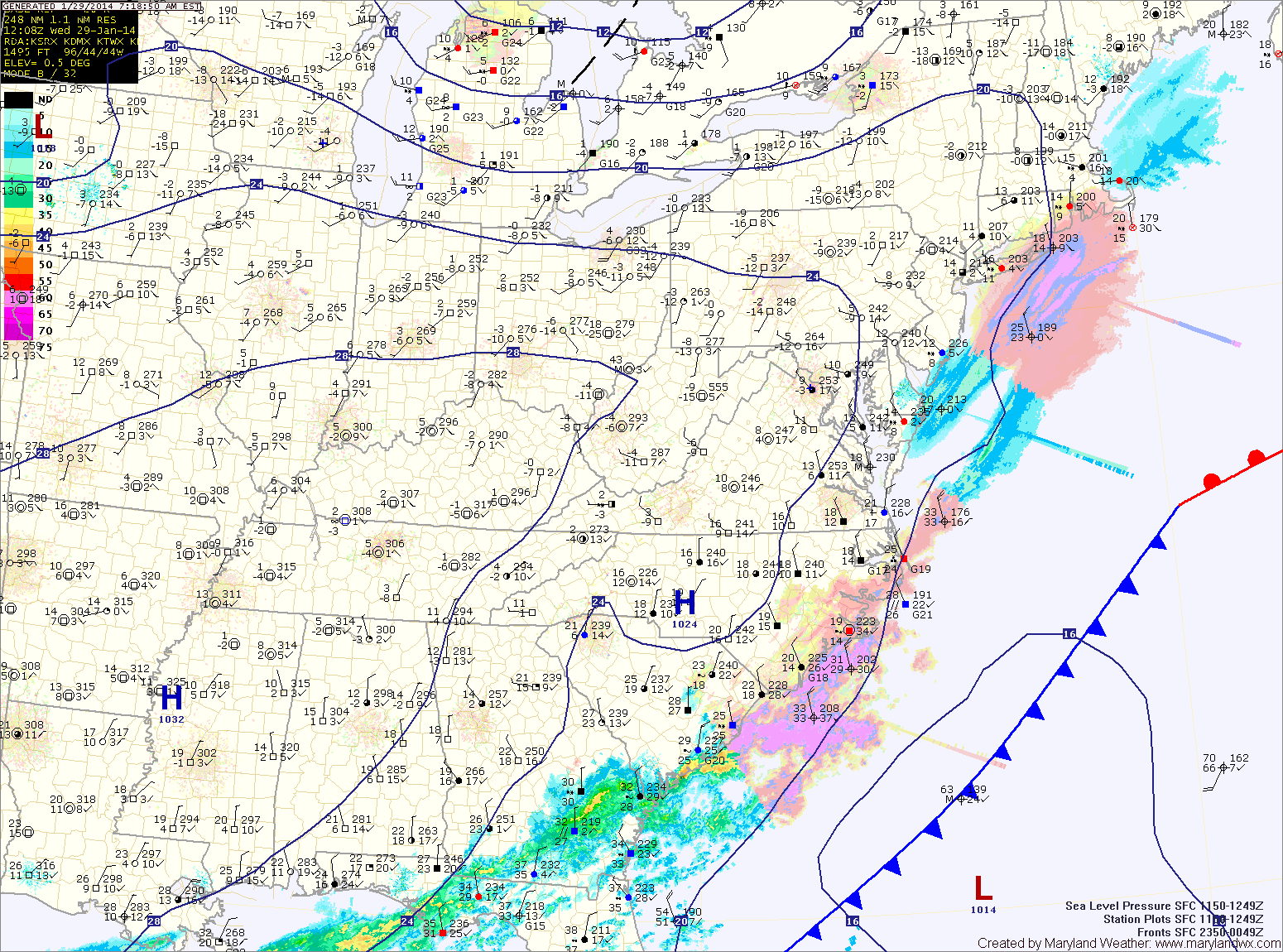
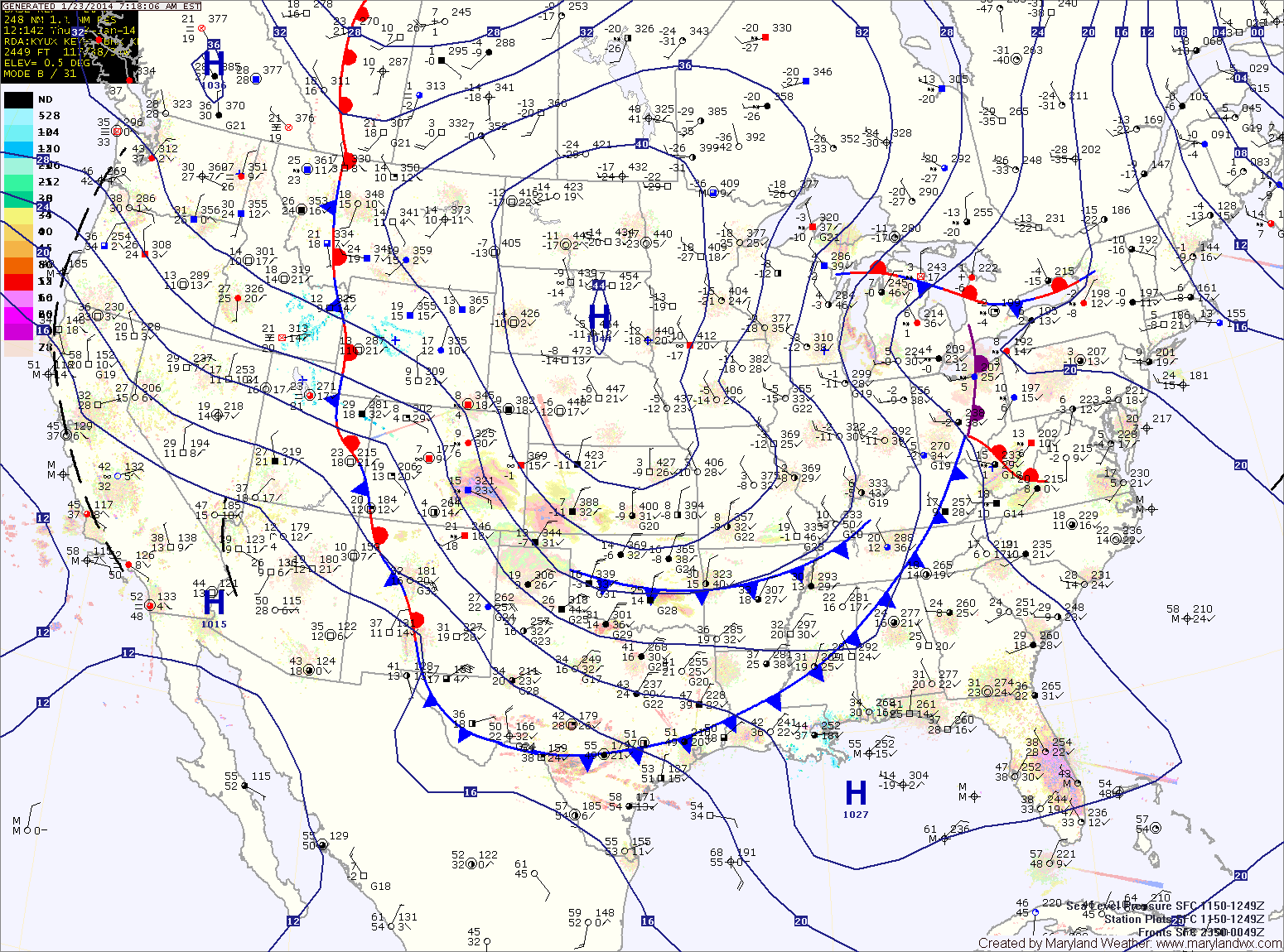
Current Surface MapThe storm system that brought snow to the deep south clipped our state overnight, spreading anywhere from a dusting north and west of I-95 to 5″ across the lower eastern shore. As that system departs, high pressure will build in. As a result, today will be mostly sunny but cold, with highs around 20.
High pressure will push offshore tomorrow allowing southerly flow to warm temperatures into the weekend. Highs tomorrow will be around 30 under mostly sunny skies.
Friday will see increasing clouds and temperatures returning to near normal, with highs in the low 40s.
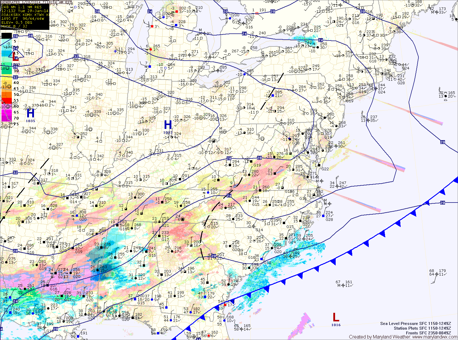
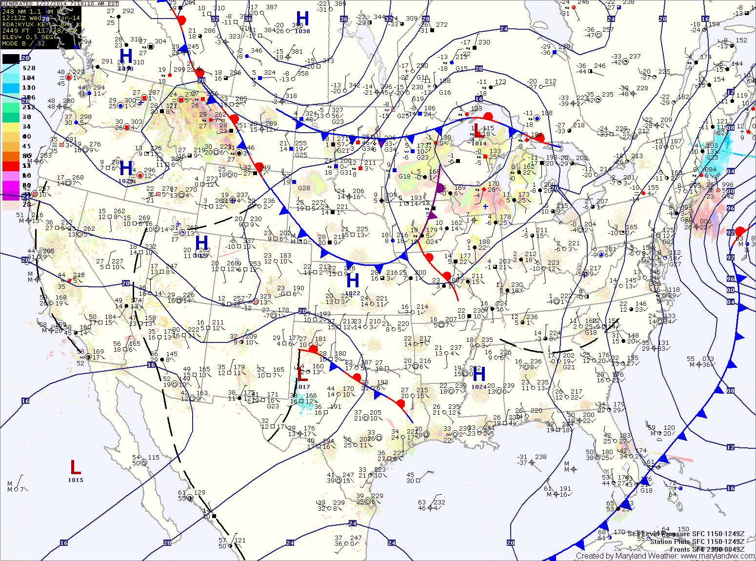
Current Surface MapToday will be generally cloudy and cold throughout the state as an area of low pressure develops over the deep south and moves towards the Carolina coast. Highs will top out around 20 degrees.
A Wind Chill Advisory is in effect through mid morning as wind chills drop to below 0 at times.
Widespread heavy snowfall is expected across most of Virginia and the Carolinas where up to a foot of snow may fall. We will be on the northern fringe of the storm here in Maryland. That said, lower southern Maryland and the lower eastern shore will likely see snow develop late this afternoon and into tonight. 1-2″ of snow is possible across St. Mary’s and Calvert counties while the eastern shore may see upwards of 4 inches.
Current Surface MapA cold front is to our west this morning. Ahead of the front, souther flow has pushed milder air up the coast and into our region. Temperatures this morning are around 40 degrees.
The front will make steady progress as it marches eastward today. Expect temperatures to begin to drop this afternoon, falling through the evening and reaching overnight lows in the single digits.
Tomorrow will be partly sunny, cold and windy. A Wind Chill Advisory goes into effect at 1am and will last through the morning hours as highs only reach the mid to upper teens tomorrow afternoon.
Current Surface MapArctic air remains over the area today as high pressure builds in. Today will be mostly sunny with highs only reaching the upper teens to near 20 degrees.
Clouds will increase tonight as another clipper system approaches. The clipper will push through tomorrow bringing light snow to the area. Minor accumulations of a dusting to perhaps an inch are possible before the snow ends tomorrow evening.
It will be warmer than recent days with highs reaching the low 30s.
Current Surface MapAfter hitting a low of 3 this morning, temperatures will climb into the mid 20s today.
A cold front will push through today bringing a slight chance of snow showers and a reinforcing shot of cold air.
High pressure will build in tomorrow, providing sunny skies but colder temps with highs only around 20.
Another clipper system will move through Saturday. This system will bring another chance of snow showers during the morning and into the afternoon. It will be a bit warmer, with highs likely above freezing for the first time since early Tuesday morning.
Current Surface MapYesterday’s snowstorm has departed the area and has brought in cold arctic air. Snowfall totals range from around 10″ near the PA border, to 7″ at BWI to 1-4″ across southern Maryland and on the lower eastern shore.
A Wind Chill Advisory is in effect for central Maryland until noon for wind chills to -15. Highs today will be in the low teens with gusty winds.
A clipper system will move into the area tomorrow, bringing a chance of snow showers during the afternoon along with more cold air. Highs will be in the low 20s.
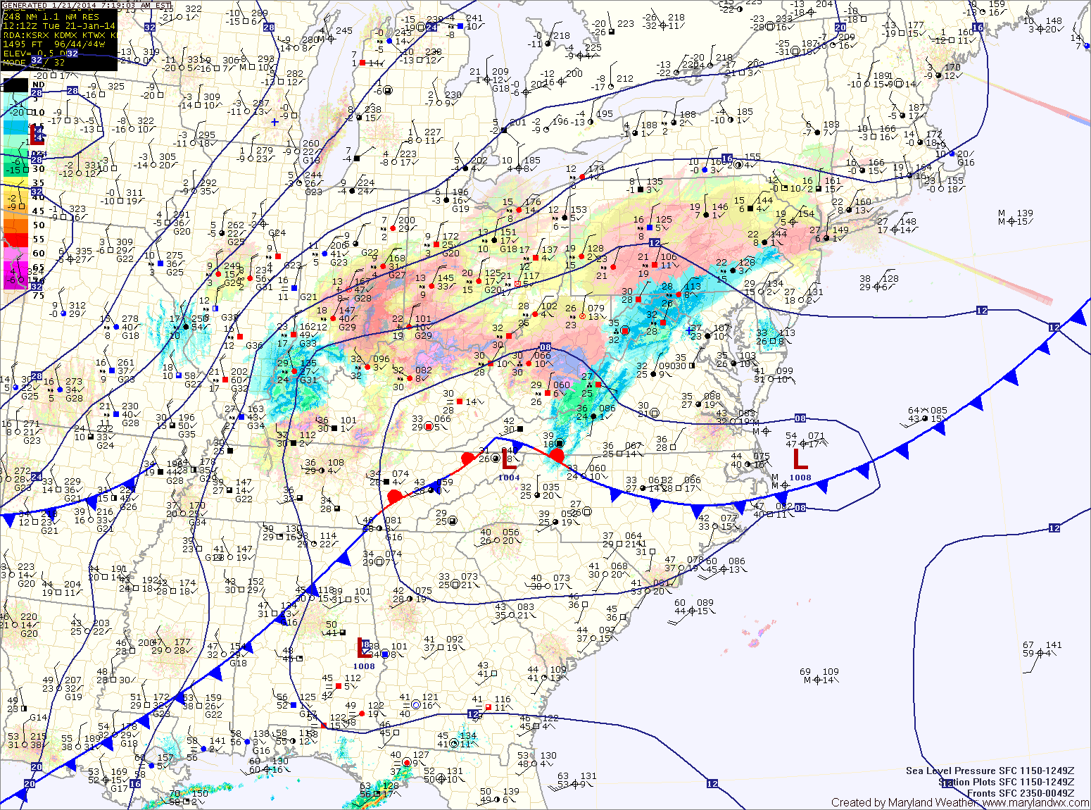
Current Surface MapThe snow shield continues to push eastward, and is overspreading I-95 at this time.
Meanwhile, cold air continues to pour into the area as temperatures are dropping into the 20s. Temperatures will continue to fall, reaching the teens by evening.
The snow will continue to push eastward and will overspread the entire state by noon. It will increase in intensity and become heavy at times during the afternoon hours.
A Winter Storm Warning is now in effect for the entire state and will remain in effect into tonight.
Snowfall Totals (from west to east):
Western Maryland mountains: 6-8″
North Central/Eastern Maryland: 8-12″
Central Maryland, including the DC/Balt. metro: 6-10″
Lower Southern Maryland: 4-8″
Eastern Shore: 6-10″
Lower Eastern Shore: 4-6″
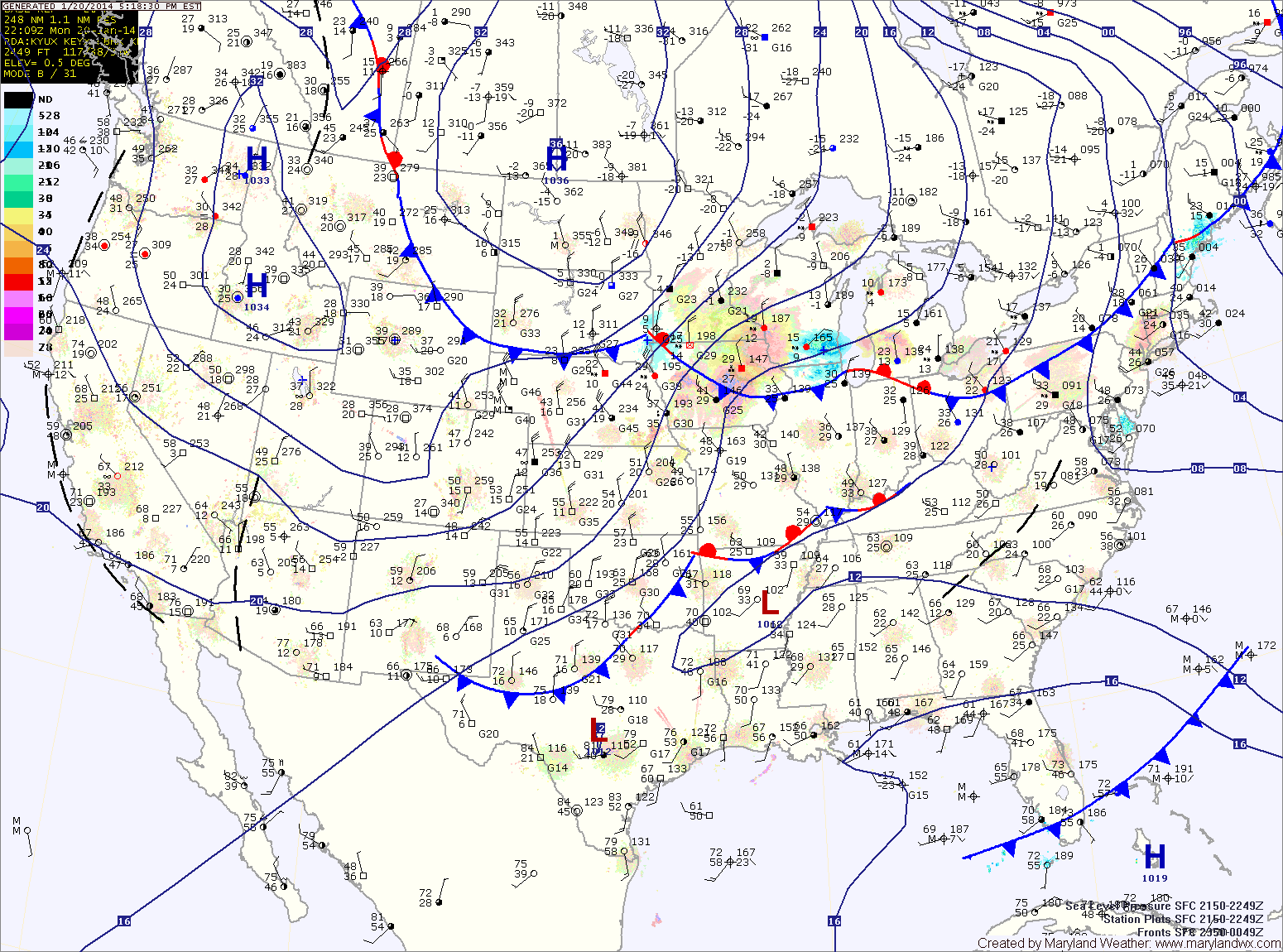
Current Surface MapA moderate to high impact snowstorm will affect the area tomorrow. An arctic front is moving into the area from the north and will usher in very cold air. This will set the stage for an area of low pressure to form and move eastward over Virginia and then up the coast.
A Winter Storm Warning has been issued and goes into effect tomorrow morning for the entire state.
Snow will move into the area during the morning hours, starting around 3am in far western Maryland, between 8 and 10am in central Maryland and between 11 and noon on the eastern shore.