
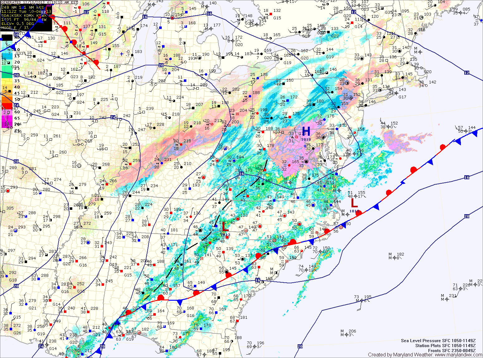
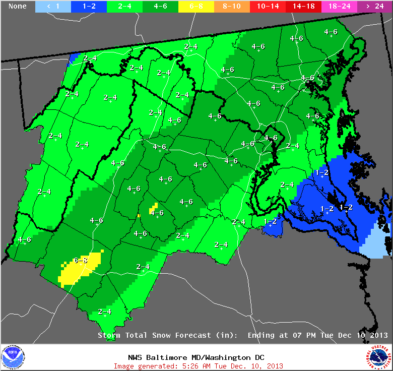
Expect the snow to last into the afternoon with totals of 1-2″ across lower southern Maryland, increasing to 3-6″ across central Maryland and tapering back down to 2-4″ to the north and west.
A Winter Storm Warning is in effect for central Maryland and a Winter Weather Advisory is in effect for southern and eastern Maryland as well as the western part of the state.
Tomorrow will be sunny but cold, with highs around 30.
Sunny skies will continue on Thursday and it will remain cold with highs in the low 30s.
Friday will see an increase in clouds as another storm moves towards the area. Highs will be in the mid 30s.
Expect another wintry mix situation on Saturday into Sunday as an area of low pressure moves in from the south.
Yesterday’s Weather Station Stats:
High Temp: 35.8°
Low Temp: 31.7°
Rain: 0.88″