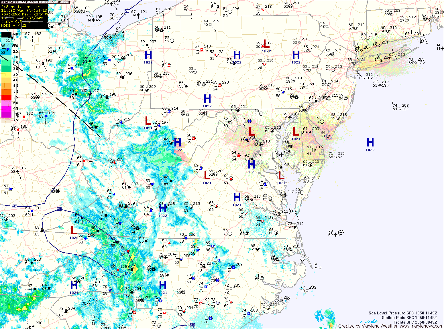
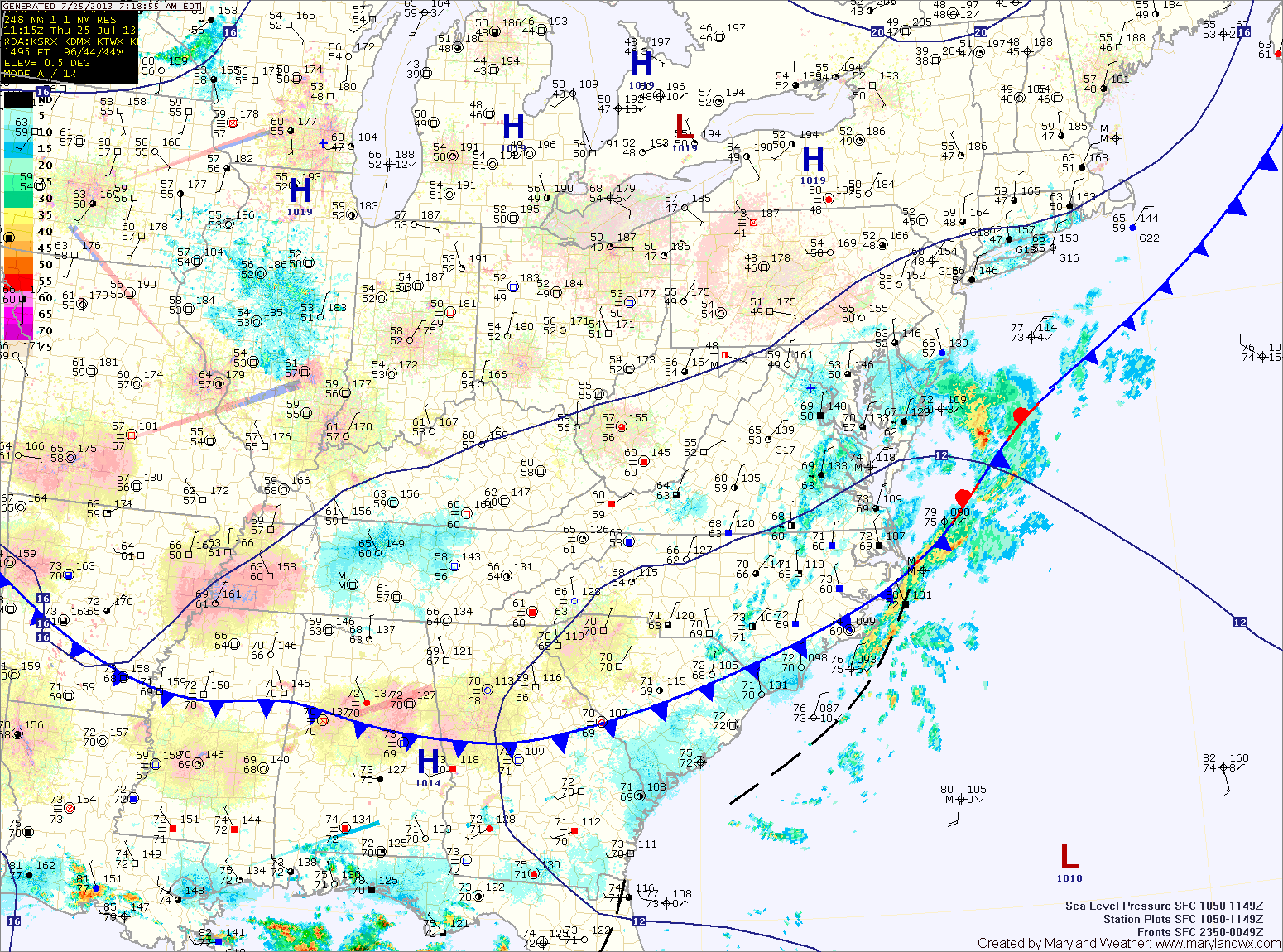
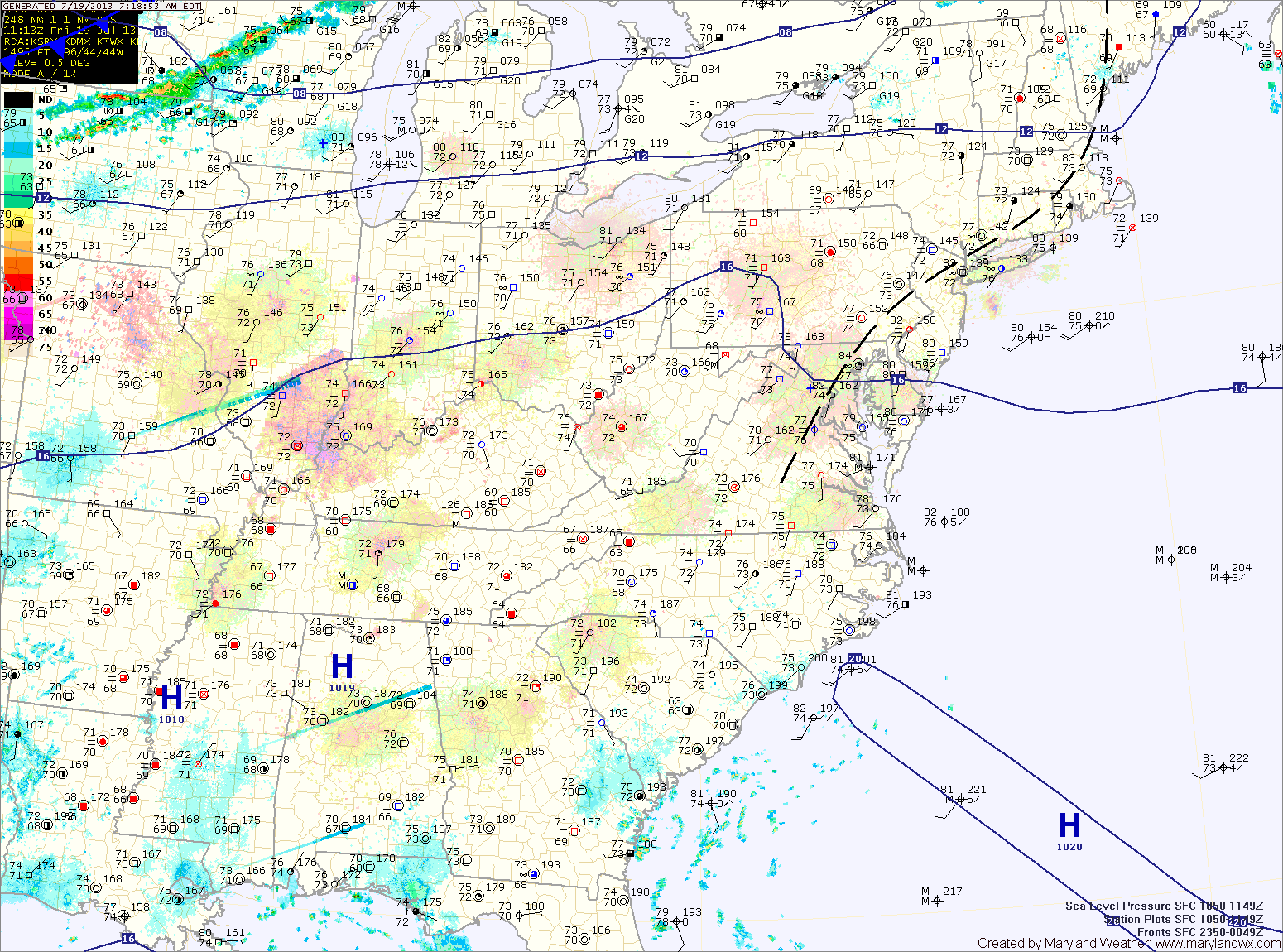
Current Surface MapToday will be a transition day as high pressure is pushed off the coast and a cold front approaches from the west. It will be more humid with isolated showers and thunderstorms possible this afternoon and evening. It will otherwise be partly sunny with highs in the mid 80s.
Shower chances increase later tonight as a disturbance moves by ahead of the front.
Showers and thunderstorms are likely tomorrow as the front moves into and through the area. Some of the storms could produce locally heavy rainfall. Highs will be in the mid 80s.
Current Surface MapHigh pressure moves overhead today, bringing us another nice day, with mostly sunny skies and highs in the mid 80s.
The high is pushed off the coast tomorrow and southerly flow will allow the humidity to increase. Afternoon and evening showers and thunderstorms are possible. Highs will be in the mid 80s.
A cold front will approach Thursday and move through Thursday night. The front will trigger more showers and thunderstorms Thursday afternoon and evening. Some of the storms could produce gusty winds and locally heavy rainfall. Highs will be in the low to mid 80s.
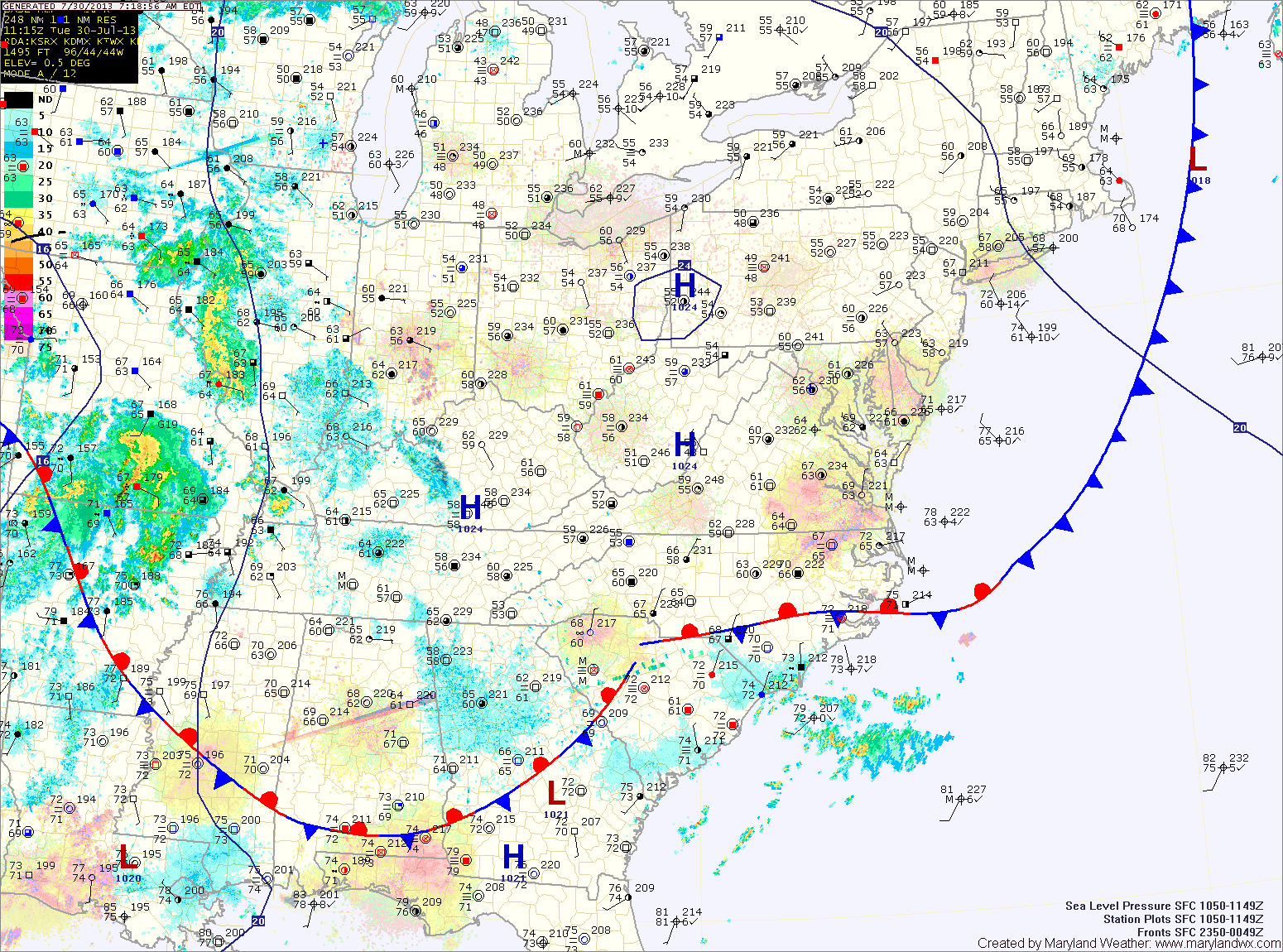
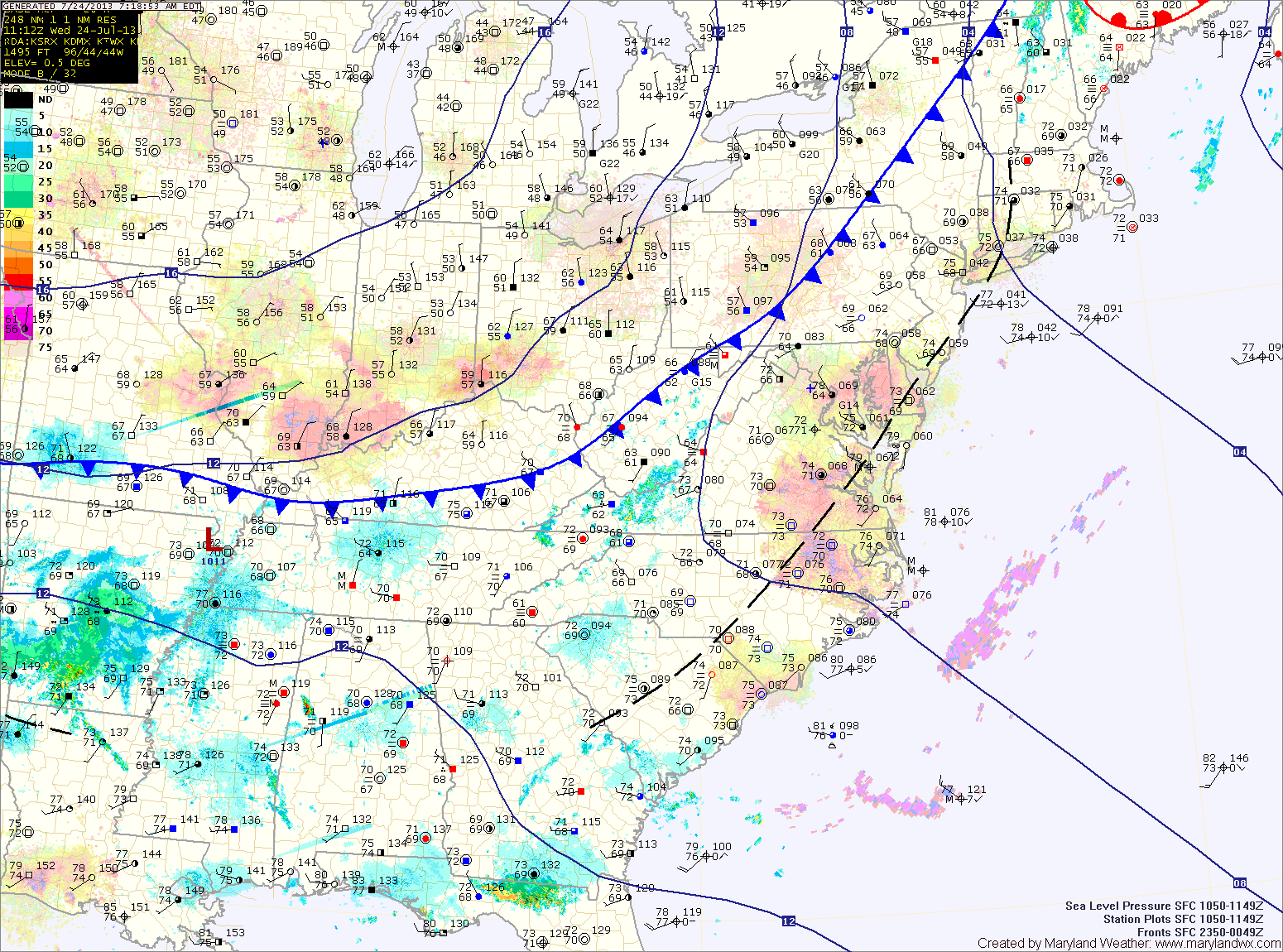
Current Surface MapA cold front has moved off of the coast, ushering in high pressure and lower humidity. Today will be mostly sunny with highs in the mid 80s.
The high will move overhead tomorrow, bringing another mostly sunny day with highs in the mid 80s.
A cold front to the west will push the high offshore tomorrow night and into Wednesday. This will allow southerly flow to develop leading to increased humidity and a slight chance of afternoon showers and thunderstorms. Highs will be in the mid 80s.
The front will move into the area on Thursday, bringing an increased chance of showers and thunderstorms. Highs will be in the mid 80s.
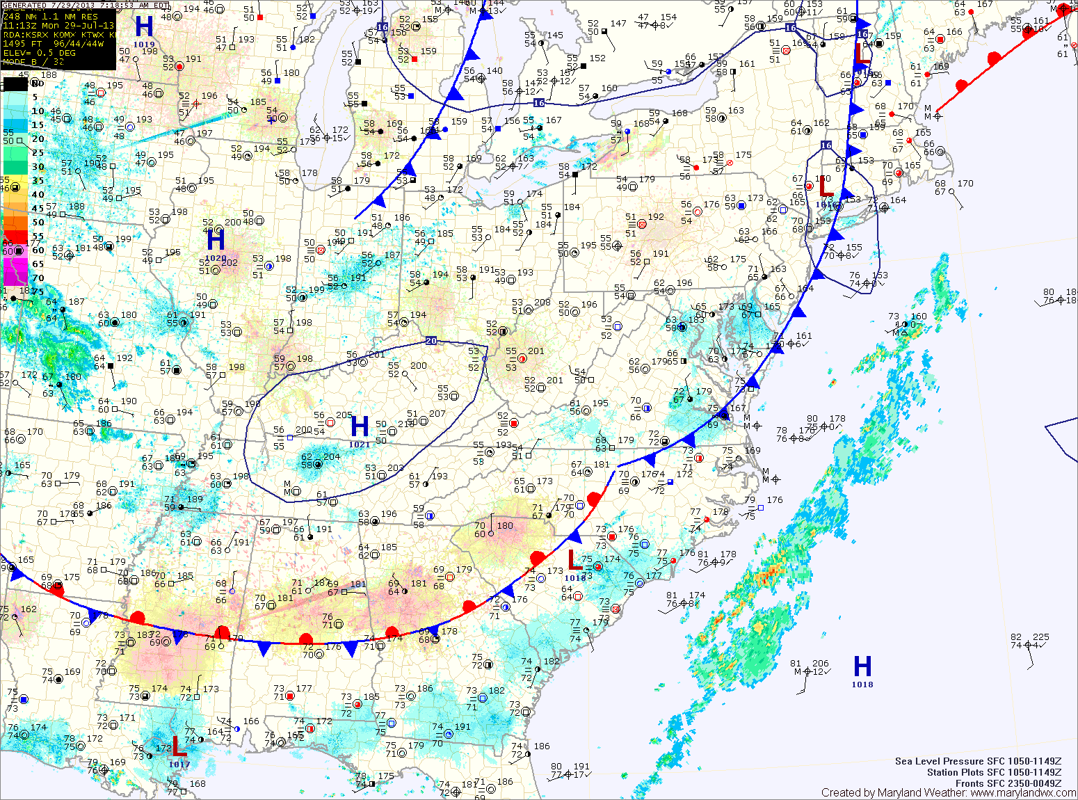
Current Surface MapHigh pressure will move overhead today providing another nice day with mostly sunny skies and highs in the low to mid 80s.
A cold front currently over the midwest will move towards the area tomorrow, pushing the high pressure off the coast and allowing southerly flow to develop. This will cause temperatures and humidity to increase along with isolated afternoon thunderstorms. Highs tomorrow will be in the mid 80s.
Showers and thunderstorms will be likely on Sunday as the front moves into the area. The rainfall will taper off Sunday night as the front pushes through. Highs on Sunday will be in the mid 80s.
Current Surface MapA cold front has passed through the state and is just off shore. The front has brought much cooler and drier air to the region, dropping dew points into the 50s and setting up afternoon highs in the upper 70s to near 80.
An area of low pressure moving along the front will keep clouds over the area and bring showers to the lower eastern shore today into tomorrow.
Clouds will decrease during the day tomorrow as the coastal low moves away from the area. Highs will push back into the mid 80s.
Another cold front will move towards the area on Saturday and southerly flow will develop ahead of it. This will bring a return to warmer and more humid conditions. Scattered afternoon showers and thunderstorms will be possible. Highs will be in the mid to upper 80s.
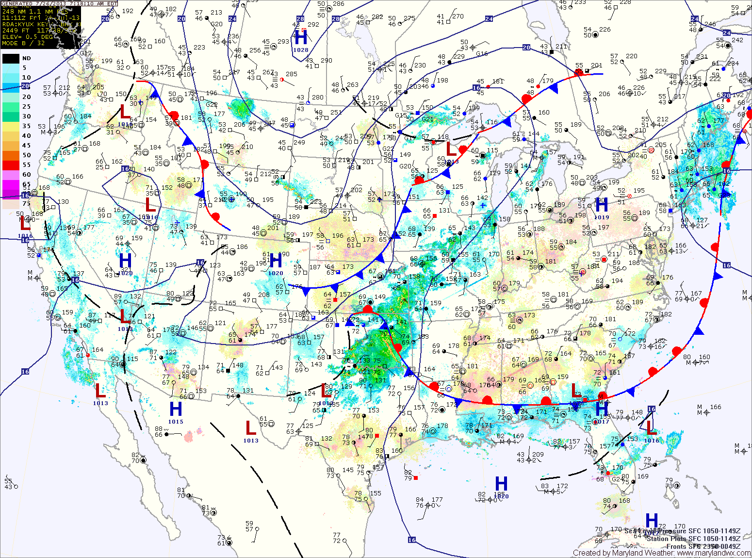
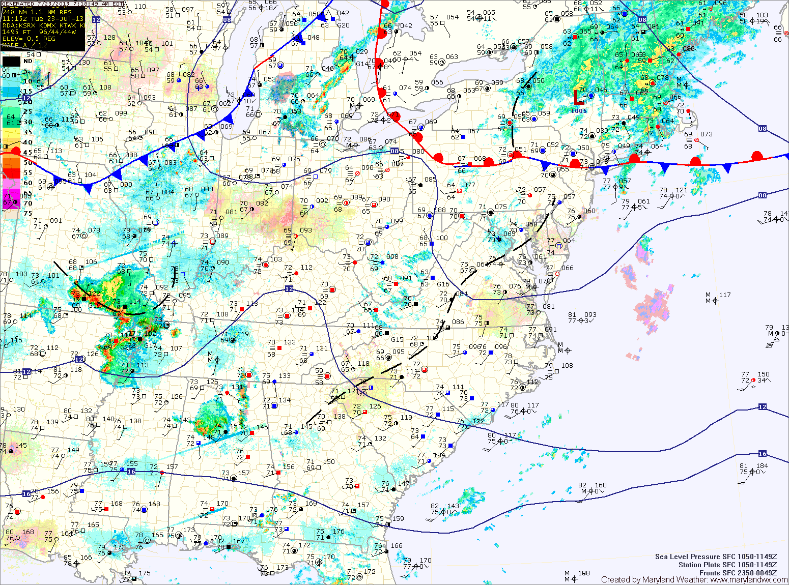
Current Surface MapAs a cold front slips through the state today, partly sunny skies will dominate the day with just a slight chance of an isolated afternoon thunderstorm. Highs will be in the mid 80s.
The cold front will usher in much drier air and set up a Thursday that will feature below normal temperatures. Highs will top out around 80 degrees with dew points in the 50s.
Clouds will still be prevalent on Friday, as an area of low pressure moves along the front, just off shore. The low should be far enough away to keep the area dry, despite the clouds. Highs will rebound a bit and push into the low to mid 80s.
Current Surface MapToday will be much like yesterday with highs in the upper 80s and scattered afternoon and evening thunderstorms.
A cold front will push southward tomorrow bringing another slight chance of storms but also cooler and drier air for the remainder of the work week. Highs tomorrow will be in the mid 80s.
Thursday looks mostly sunny and dry, with low humidity and highs in the low 80s.
Friday will be similar to Thursday, mostly sunny with highs in the low to mid 80s.
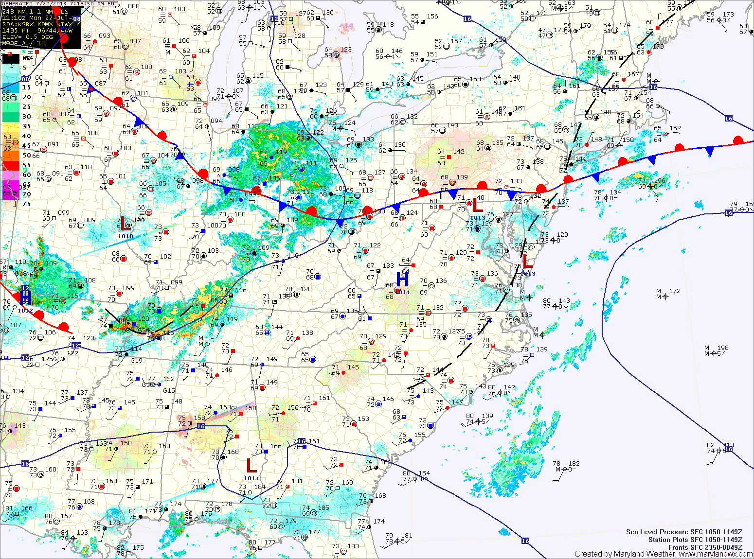
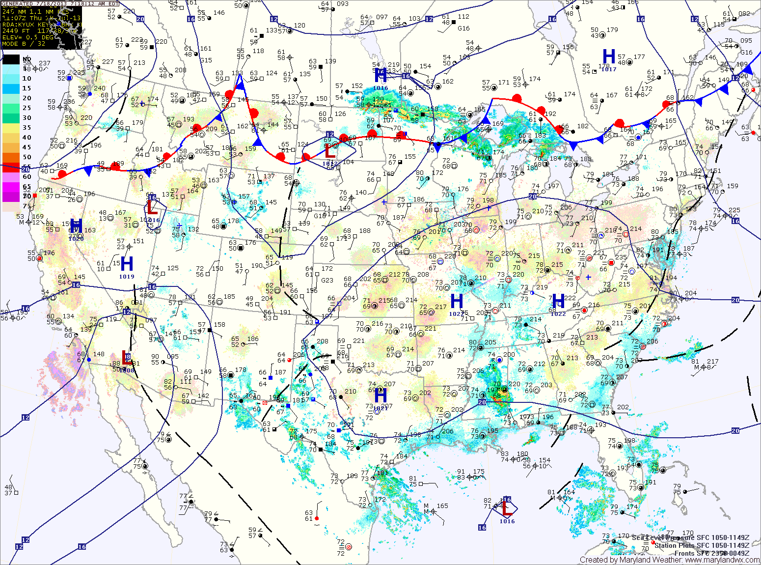
Current Surface MapThe frontal boundary that brought showers, storms and relief from the heat has stalled out in our area.
Several areas of low pressure will push through the region along the front bringing unsettled weather for much of the week.
Today will be mostly cloudy with highs in the mid 80s. Scattered showers and thunderstorms are likely this afternoon and evening. These storms could produce locally heavy rainfall.
Thunderstorm chances decrease slightly tomorrow, but isolated to scattered storms will still be possible. Highs will be in the mid to upper 80s.
Current Surface MapAnother hot and humid day is on tap today. Highs will once again be in the mid to upper 90s with heat index values near 110. An Excessive Heat Warning is in effect for Washington and Baltimore, while a Heat Advisory is in effect for the surrounding counties in central Maryland.
There will also be scattered thunderstorms this afternoon. The storms will be capable of producing gusty winds, heavy rainfall and large hail.
A cold front will approach tomorrow, but will remain to our north resulting in another hot and humid day with afternoon and evening thunderstorms. Highs will be in the mid 90s. The storms could be strong to severe, with damaging winds, large hail and locally heavy rainfall.
Current Surface MapHigh pressure will move overhead today and bring the hottest conditions of the week. Highs will likely top out in the mid to upper 90s with higher humidity values making it feel over 105. A Heat Advisory is in effect central Maryland through this evening.
Afternoon thunderstorms will likely develop over the mountains and move eastward towards the Baltimore/Washington metro during the late afternoon hours. This activity is expected to be isolated but areas that do see storms could see brief heavy rainfall and gusty winds.
Tomorrow will be similar to today, possibly a few degrees cooler with a slight chance of afternoon storms. Highs will be in the mid 90s with dewpoints in the low to mid 70s and heat indices near 105.