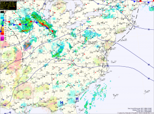
The storm threat will last into the evening before waning over night.
Another steamy day on tap tomorrow, but winds will increase as a cold front approaches from the west. More storms are expected in the area, capable of producing damaging winds and large hail. Highs will be around 90.
The front will stall out Thursday night and another will approach on Friday. More scattered storms are likely with the fronts in the area. Highs on Friday will be in the upper 80s to around 90.
This front will also weaken and stall out and eventually dissipate. This will leave the area in warm, moist, unstable air through the weekend and into next week. Thunderstorms will be possible each day through Tuesday of next week, with highs in the mid to upper 80s each day.
Yesterday’s Weather Station Stats:
High Temp: 93.9°
Low Temp: 67.5°
Rain: 0.21″
