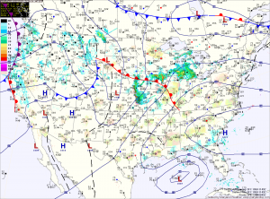
More of the same tomorrow, with highs in the mid 90s and afternoon showers and storms possible. Some of the storms could turn severe with damaging winds and large hail possible.
A weak cold front will approach the region on Thursday, increasing thunderstorm activity and the likelihood of severe weather. Highs on Thursday will be around 90 degrees.
The front will slow and stall out in the area on Friday, maintaining shower and thunderstorms across the state. Highs will be held back, only reaching the mid 80s.
Right now, it appears the front will remain blocked up and in the vicinity through the weekend. This will keep our weather unsettled on Saturday and Sunday with afternoon showers and storms possible both days. Highs over the weekend will be in the low to mid 80s.
The unsettled weather will continue as we move into next week.
Yesterday’s Weather Station Stats:
High Temp: 92.7°
Low Temp: 70.6°
Rain: 0.04″
