Expect decreasing clouds this afternoon and highs in the upper 70s to around 80.
Tomorrow will be pleasant, with ample sunshine and highs in the low 80s with low humidity.
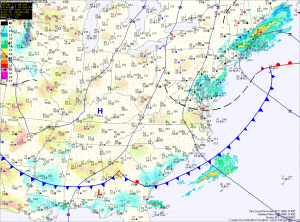
High pressure will slide off the Carolina coast Saturday night, setting up southerly flow while a cold front moves southward towards the area. This will cause temperatures to warm, humidity to increase and touch off an isolated afternoon shower or thunderstorm. Highs on Sunday will be in the mid 80s.
The shower and storm threat will continue Monday and Tuesday. Highs will be in the mid to upper 80s.
Low pressure will eventually push the front through and high pressure will build in for the second half of the work week bringing drier conditions.
Yesterday’s Weather Station Stats:
High Temp: 86.4°
Low Temp: 69.4°
Rain: 0.42″
