Current Surface MapWith high pressure remaining off the coast and southerly flow continuing, today will be similar to the past few with highs in the low to mid 90s. There will be a bit more cloud cover today as a cold front approaches from the west. An isolated shower or thunderstorm will be possible this afternoon and evening.
The front will continue to move towards the region tomorrow but southerly flow will continue ahead of it. Expect another day near 90 degrees under mostly sunny skies. Isolated showers and thunderstorms are possible, mainly across northern and western Maryland.
Current Surface MapThe high pressure that was to our west and brought pleasant conditions for the Memorial Day weekend has moved off shore and is strengthening off the coast. Southerly flow around the high will continue to push warm and humid air into the region. Highs today will be around 90 degrees.
There is a slight chance for an isolated shower or thunderstorm this afternoon and evening.
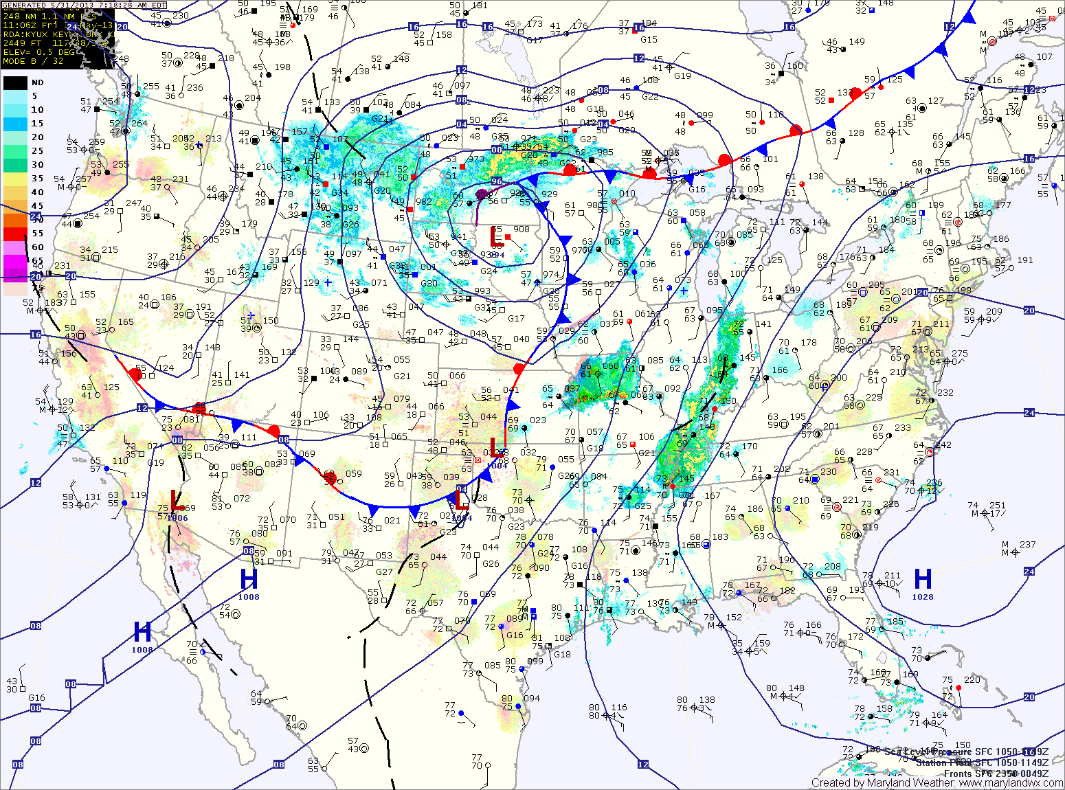
The heat will continue to build tomorrow with highs in the low to mid 90s under mostly sunny skies.
Friday looks to be a carbon copy of tomorrow. Mostly sunny, highs in the low to mid 90s.
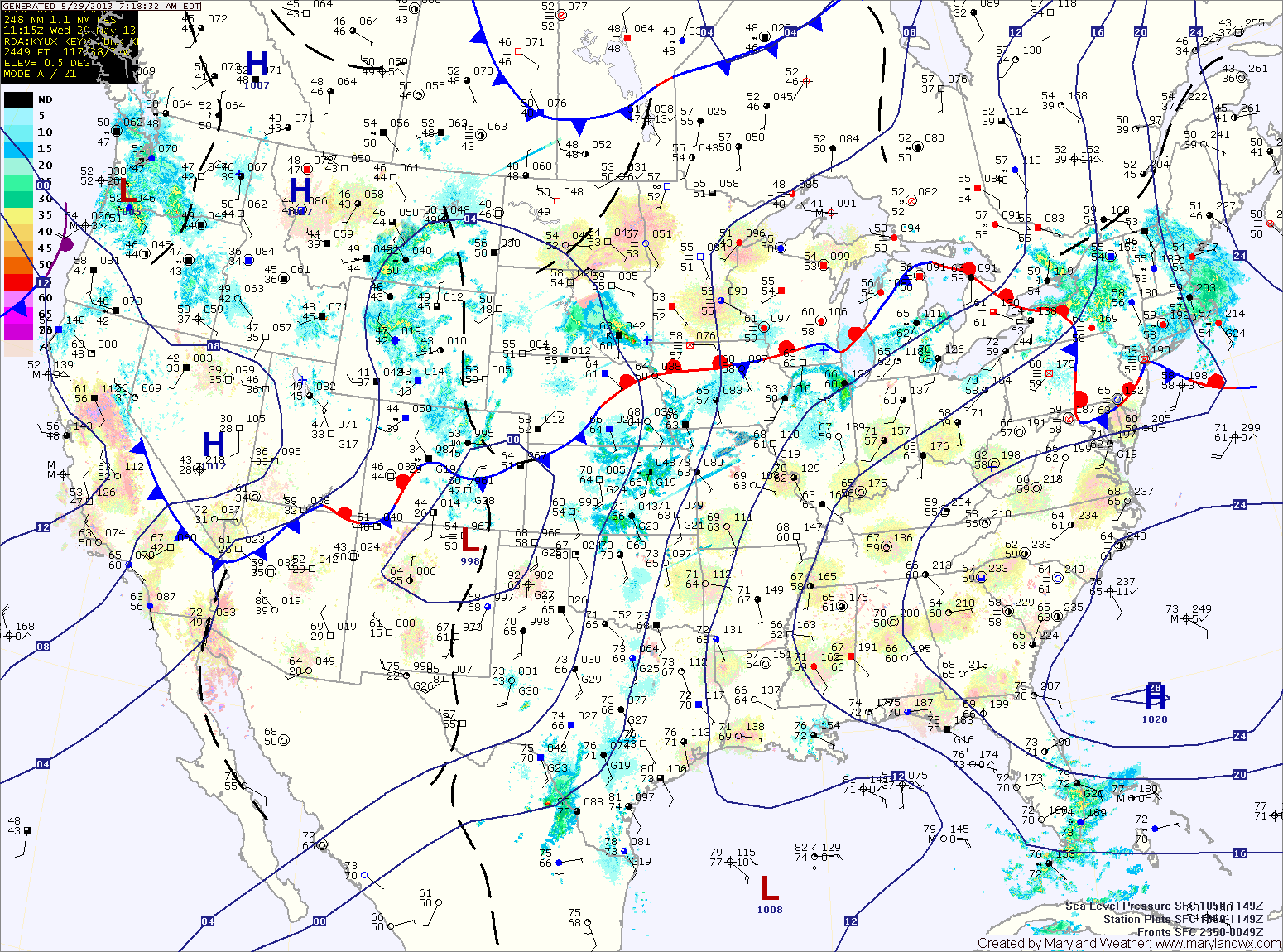
Current Surface MapA warm front is in the process of moving through the area and bringing some light showers along with it. The front will cross today, putting the area in southern flow.
Isolated showers and storms are possible through the afternoon. Highs today will be around 80 degrees.
An area of high pressure will be anchored off the coast and will become a “Bermuda High” that typically bring hot and humid conditions to the east coast. Expect mostly sunny skies with an isolated shower or thunderstorm chance tomorrow through Saturday.
It will be hot and humid with highs each day in the low to mid 90s.
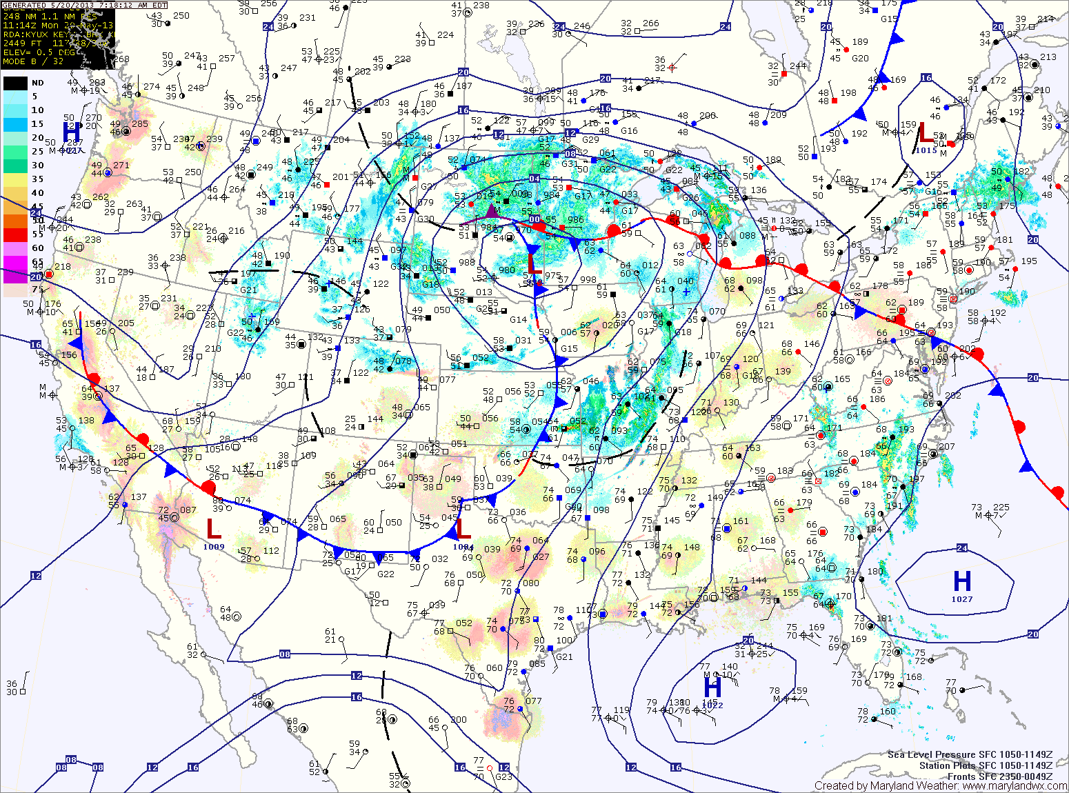
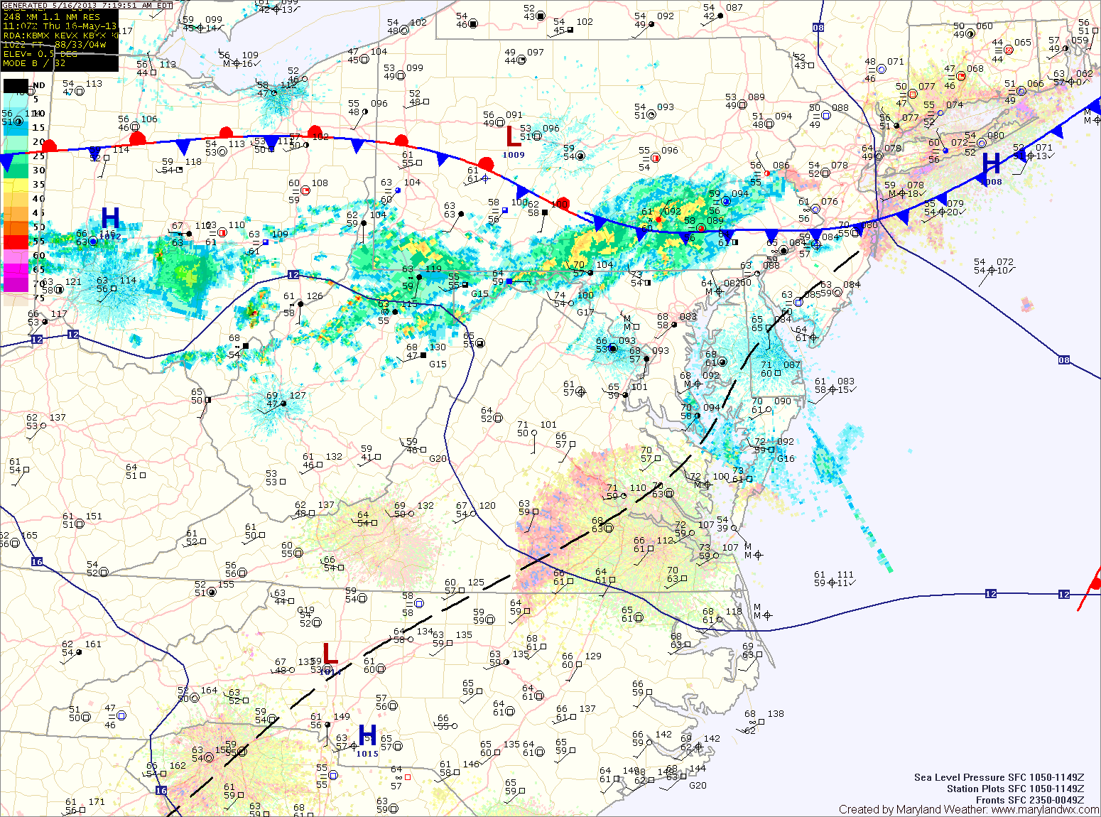
Current Surface MapA cold front moved through the area last night and has pushed off the coast. Behind it, an upper level low pressure system will keep skies mostly cloudy today with scattered showers. Highs today will only top out in the mid 60s.
Showers will decrease in coverage through tonight as high pressure takes control of the weather. Expect clearing skies tomorrow with highs in the upper 60s to low 70s.
Sunday and Monday will be dry, with mostly sunny skies both days. Highs will be around 70 on Sunday, and warming into the mid 70s on Monday.
The warming trend continues Tuesday, with highs back to around 80 under mostly sunny skies.
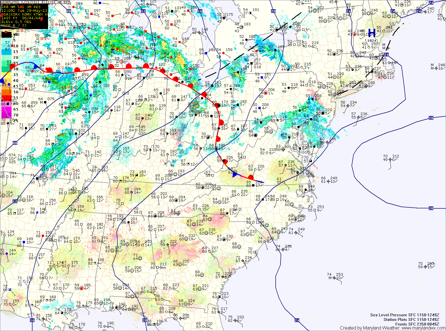
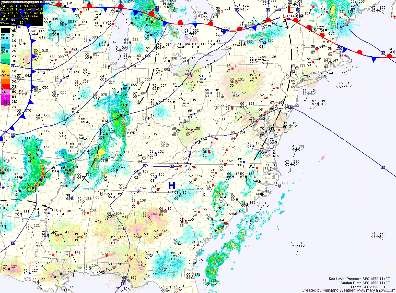
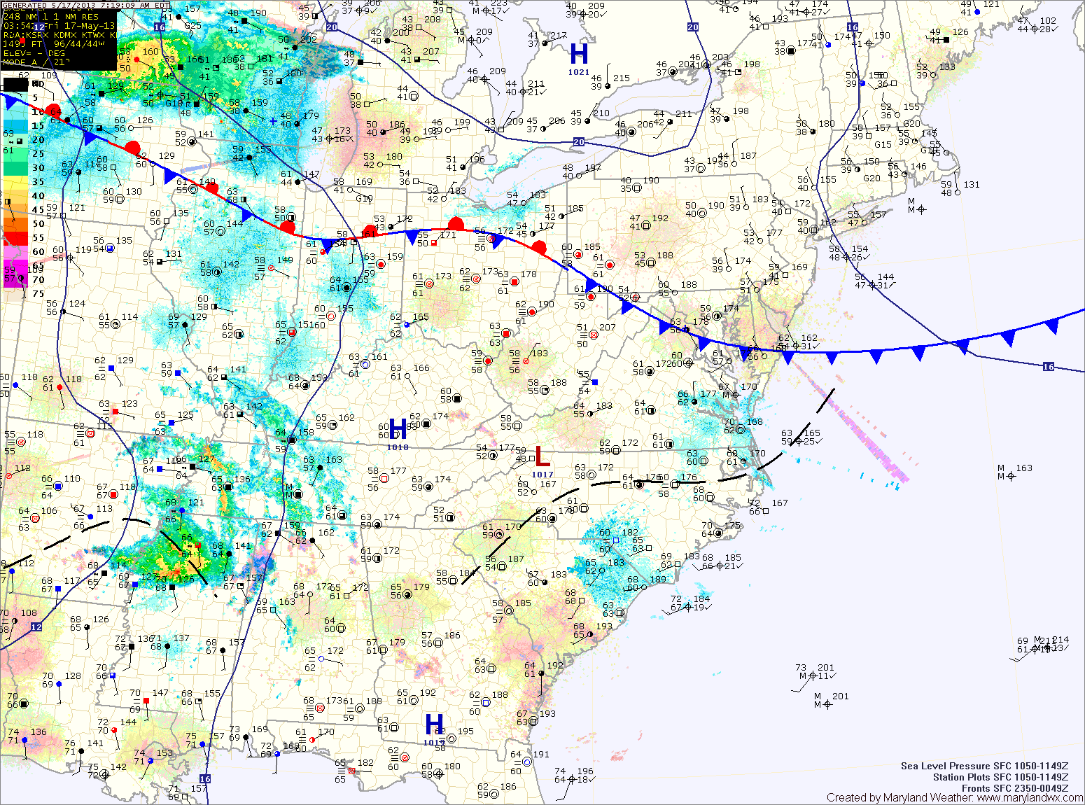
Current Surface MapA cold front will approach from the west today while high pressure off the coast continues to push warm and humid air out ahead of it. The combination of the two will trigger numerous showers and thunderstorms today. There is a slight chance that some of the storms could become severe this afternoon, with damaging wind being the primary threat. Highs today will top out around 80 degrees.
The shower threat will be ongoing tonight as the front continues to push into the area. The front will cross late tonight or early tomorrow morning.
Showers will linger through tomorrow behind the front, with highs only reaching the mid 60s.
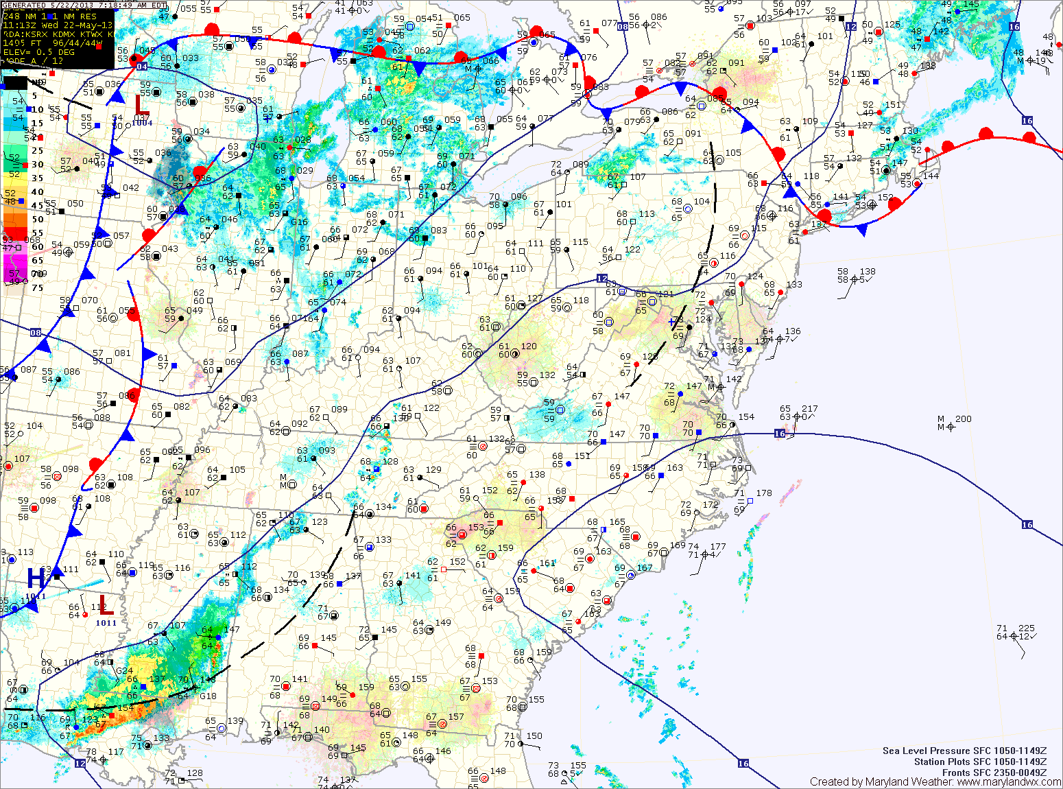
Current Surface MapHigh pressure off the coast will continue the warmth and humidity today. Highs will push into the mid to upper 80s. High dew points will make it feel even warmer. Additionally, scattered showers and thunderstorms are expected this afternoon. Some of the storms could produce strong gusty winds.
A better chance of more wide spread showers and thunderstorms tomorrow, as the cold front responsible for the severe weather over the Plains and Midwest finally pushes into our area. There is a slight chance the storms could be severe with damaging winds being the main threat. Highs tomorrow will be in the mid 80s.
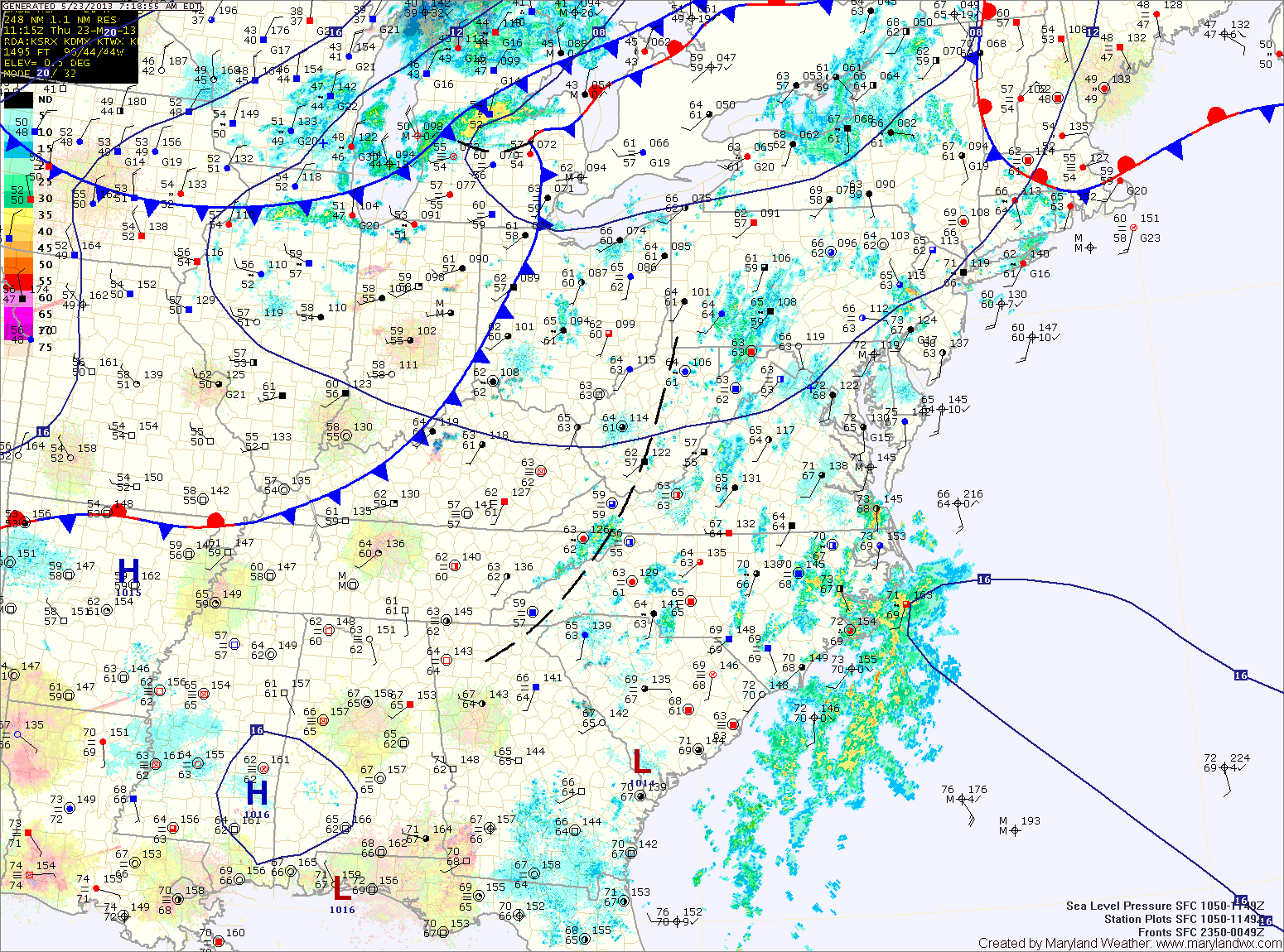
Current Surface MapWith high pressure off the coast, southerly flow will continue to pump warm and humid air into the region. Today will become mostly sunny with a high in the mid 80s. As the heat and humidity increase this afternoon, an isolated pop-up shower or thunderstorm is possible.
Tomorrow will be much like today, warm and humid with isolated afternoon showers and thunderstorms. Some of the storms may become strong to severe with damaging winds being the primary threat. Highs again in the mid 80s.
Thunderstorm chances increase Thursday afternoon as a cold front approaches from the west. Highs will be in the low to mid 80s.
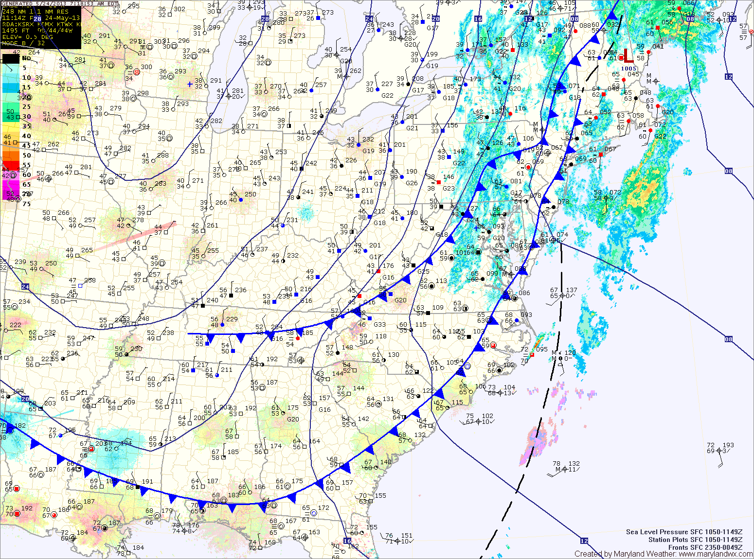
Current Surface MapA cold front will sag south of the state today, leading to a sunny day with highs in the upper 70s.
The front will stall out, just to our south and become the focus for shower activity through the weekend. Tomorrow starts out dry, with scattered showers developing in the late morning and lasting through the night. Highs will be in the low 70s.
Rain chances increase on Sunday, with more showers expected through the day and into the night. Highs will be in the low 70s.
Current Surface MapA frontal boundary to our north will slowly sink south today and as it does, it will bring scattered showers and thunderstorms to the area. Highs today will be in the low to mid 80s under generally cloudy skies.
The front will slip south of the area tomorrow, allowing for clearing skies and highs in the mid to upper 70s.
The sunshine will be short lived, however as rain chances increase again on Saturday as an easterly flow develops. Isolated to scattered showers and thunderstorms are possible Saturday afternoon and evening. Highs will be in the mid 70s.