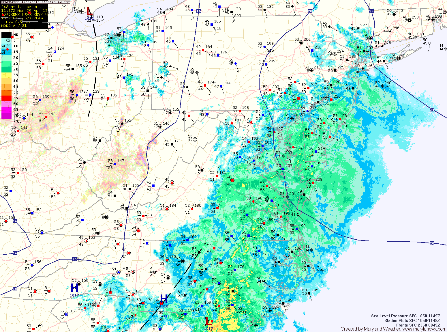
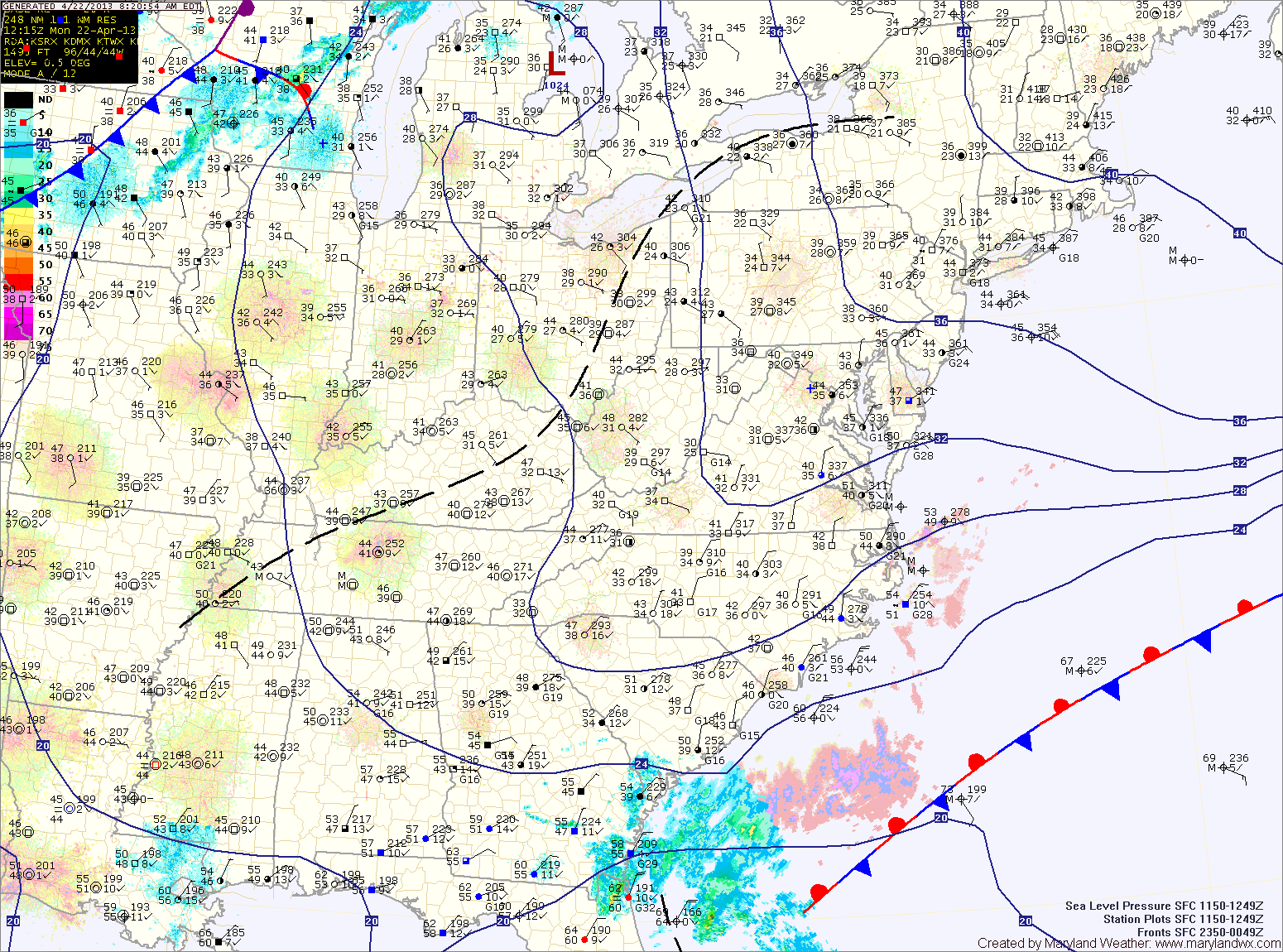
One More Day of Light Rain

Current Surface Map
Current Surface Map
High pressure off the coast will continue easterly flow off the Atlantic Ocean, fueling drizzle and light rain across the state. The rain will continue through this afternoon. Highs will be in the low 60s.

The high will push back to the west tonight and should bring an end to the rainfall. Skies will begin to clear overnight tonight.

Tomorrow, the high will continue to bring in drier air. Expect partly sunny skies with highs in the upper 60s.

The high will strengthen its influence on the area Thursday and Friday as it continues to move into the area. Highs both days will be in the mid to upper 60s under partly sunny skies.

Light Rain Today

Current Surface Map
Current Surface Map
Easterly flow combined with low pressure has resulted in a cool and damp day with light rain likely through the day and night.

The rain is mainly along and east of I-95 at this time, but will work its way westward during the day. Highs will struggle into the upper 50s.

Onshore flow with damp conditions and light rain chances will persist tomorrow and Wednesday.

The rainfall is expected to be lighter than today, but will still be in the forecast into Wednesday night. Highs both days will be in the low to mid 60s.

Mostly Sunny Today and Tomorrow

Current Surface Map
Current Surface Map
High pressure will build into the region today and tomorrow, bringing mostly sunny skies and pleasant conditions.

Highs today will be in the upper 60s, pushing into the low 70s tomorrow.

The high is pushed off the coast tomorrow as an area of low pressure pushes in from the south west. The low will bring a chance of showers to the area Sunday afternoon and evening.

Highs will be in the mid to upper 60s.

Increasing Clouds; Warm Today

Current Surface Map
Current Surface Map
Clouds will increase through the day today as a cold front approaches from the west.

Meanwhile, southerly flow will allow temperatures to warm into the low to mid 70s for highs this afternoon.

The front will cross tonight, bringing a chance of showers and thunderstorms as it does.

The front will have cleared the area by tomorrow, allowing cooler air to move in. Highs tomorrow will be in the low to mid 60s under decreasing clouds.

Partly Sunny Today; Cold Front Crosses Tomorrow Night

Current Surface Map
Current Surface Map
Low pressure off the coast will pass by the area today, continuing to bring clouds into the region. Easterly flow will keep temperatures down once again, with highs topping out in the upper 50s to low 60s.

Southerly flow will develop tomorrow, ahead of a cold front. This will allow temperatures to rise into the mid to upper 70s under partly sunny skies.

The front will cross the state from east to west during the day tomorrow. Expect showers and thunderstorms to arrive ahead of the front. Showers and thunderstorms are likely during the late afternoon and evening hours.

Partly Sunny and Cool Today

Current Surface Map
Current Surface Map
A weak area of low pressure will move up the coast today and combine with onshore flow to spread cloud cover over the state. It will continue to be cool, with a high in the upper 50s.

The low will pass by early tomorrow morning, bringing a slight chance of drizzle to the eastern portion of the state late tonight into tomorrow morning. Tomorrow will remain partly sunny with a high near 60.

A cold front will approach the area tomorrow night and Wednesday. Showers and thunderstorms are expected to break out ahead of the front and spread into the area Wednesday afternoon and night. Highs Wednesday will be closer to normal for this time of year, topping out in the upper 60s to near 70.

Cold Front to Bring Showers and Storms Today

Current Surface Map
Current Surface Map
A cold front currently pushing through Ohio and will approach and cross the state this afternoon and evening. Widespread showers and thunderstorms are accompanying the front and will move into the area during the afternoon hours.

Ahead of the front, it will be warm and windy with southwest winds gusting to near 35mph. Highs today will push into the upper 70s to low 80s.

Showers and storms will move in from west to east during the late afternoon and evening, bringing locally heavy rainfall and strong, gusty winds. Flash flooding will be possible this afternoon and evening.

Scattered Showers this Morning

Current Surface Map
Current Surface Map
A stationary boundary across Virginia this morning will push northward today as a warm front. Before it does, moist marine air is supporting scattered showers over the state.

The front will clear the state during the afternoon, allowing southerly flow to develop and clear out the showers. Highs this afternoon will top out around 70 degrees under partly sunny skies.

A cold front currently across the midwest will move towards the area tomorrow. The front will cross the state tomorrow evening, but before it does, it will spread numerous showers and thunderstorms through. Some of the storms may produce gusty winds and locally heavy rainfall. High temperatures tomorrow will be in the mid to upper 70s.

Partly Sunny; Seasonal Temps Today

Current Surface Map
Current Surface Map
A cold front is slowly sinking south through the state this morning and will settle south of the area this afternoon. Highs across the state will be in the upper 60s to low 70s.

Easterly flow will develop behind the front this evening, bringing in cool and moist air overnight.

Southerly flow will take over tomorrow, scouring out the cool/damp air and replacing it with warm humid air. Highs will push into the low to mid 70s.

A cold front will approach on Friday. Ahead of the front, showers and thunderstorms will develop and move into the area Friday afternoon. Some of the storms may produce gusty winds and locally heavy rain. Highs on Friday will be in the mid 70s.