
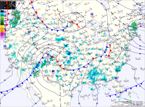
A strong storm system that will bring heavy snow to the midwest will begin to spread clouds into our area tonight. The clouds will thicken tomorrow as the storm brings a strong cold front through the region.
Rain will develop out ahead of the front and will spread into the area during the late afternoon. Highs will be in the mid to upper 40s.
The rain will continue tomorrow night and into Friday morning. In the mountains of far Western Maryland, it will be cold enough for snow. Winter Storm Watches have been issued for Garrett and Allegany counties where near blizzard conditions are expected into Saturday.
The front will clear the area during the morning hours on Friday, followed by gusty winds and colder air.
Highs Friday will struggle into the low 40s. The cold air, combined with wind gusts to around 30mph will make it feel much colder.
A blustery weekend is on tap, as cold high pressure builds in. Highs Saturday and Sunday will be around 40 degrees, with gusty winds continuing.
The cold air will stick around into next week, with highs on Monday near 40 degrees before beginning to moderate as we push towards mid week.
Yesterday’s Weather Station Stats:
High Temp: 58.0°
Low Temp: 40.4°
Rain: 0.01″