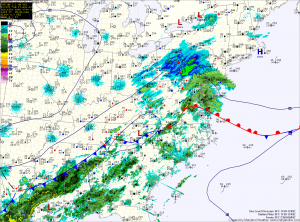
Light rain will continue to fall across central and eastern Maryland, while rain mixing with snow at times will fall across northern Maryland. All snow can be expected across far western Maryland.
The precipitation will taper off from west to east this afternoon, ending by this evening as high pressure pushes in from the west.
High pressure will remain in control Wednesday through the weekend. Expect mostly sunny skies and temperatures in the mid 40s Wednesday and Thursday, warming to near 50 Friday and into the 50s this weekend.
The next chance of rain looks to be late Sunday into Monday.
Yesterday’s Weather Station Stats:
High Temp: 52.7°
Low Temp: 24.5°
Rain: 0.00″
