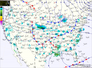
Low pressure currently developing over eastern Texas will move northeast today and will pass by to our south late tonight and tomorrow morning. The storm will be fairly weak and fast moving, which will limit the amount of precipitation that will fall.
Currently it appears that temperatures will be cold enough for rain to change to snow across the northern and western part of the state. In these areas, a slushy inch or two of snowfall is possible.
Further east, in central and southern Maryland, surface temperatures should remain warm enough for most of the precipitation to fall as rain. There could be a few snow flakes mixed in from time to time before it all ends Tuesday afternoon.
This forecast could change if the storm strengthens more than anticipated or if it slows down. If this were to happen, snow could fall further east.
High pressure builds into the region late Tuesday into Wednesday. This will bring a return of sunshine and chilly air. Highs Wednesday through Friday will be in the mid to upper 40s.
Temperatures are expected to warm as the high pressure moves off the coast as we head into the weekend. Highs will be around 50 on Saturday, warming to the mid to upper 50s on Sunday.
Yesterday’s Weather Station Stats:
High Temp: 41.5°
Low Temp: 25.6°
Rain: 0.00″
