Sandy Making Landfall on New Jersey

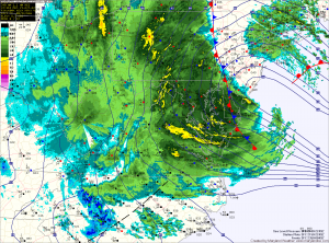
Current Surface Map
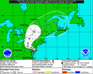
Hurricane Sandy is roaring onshore along southern New Jersey. Hurricane force wind gusts are now overspreading the state. Winds will continue to increase to 30-50mph with gusts to 70mph likely through tomorrow morning.

5:00pm Forecast Track
Rainfall totals of 8-12 inches are also likely across central and eastern Maryland. These rainfall totals combined with the winds will cause major tree and power line damage.

Widespread power outages are likely as we move through the night and into tomorrow.

The rainfall will taper to 2-6 inches for the western portion of the state, while in far Western Maryland, a Blizzard Warning remains in effect where 18-24 inches of snow are likely.

The storm will begin to slowly wind down for us here in Maryland as we move towards tomorrow afternoon.

Winds will still gust to 35-45mph through tomorrow night as the rain tapers off to showers.