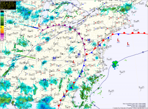
This front should push northward today, allowing for partial clearing. Temperatures should push into the mid 80s in areas that end up south of the front.
The entire system will clear the area tonight but as it does so, isolated showers are possible during the overnight.
Temperatures will continue to be warm tomorrow and Friday under mostly sunny skies. Highs both days will push into the mid 80s.
Another fairly warm day on Saturday, but cloud cover will increase as a strong cold front approaches from the west. Shower chances will increase through the day on Saturday and into Sunday as the front crosses.
The front should clear the area Sunday, ushering in much cooler air. Highs Sunday are expected to be in the low to mid 60s.
The cool air will stick around into the work week with highs in the low to mid 60s expected Monday and Tuesday. Overnight lows will dip into the low 40s with upper 30s possible in some of the colder spots.
Yesterday’s Weather Station Stats:
High Temp: 69.3°
Low Temp: 61.1°
Rain: 0.25″
