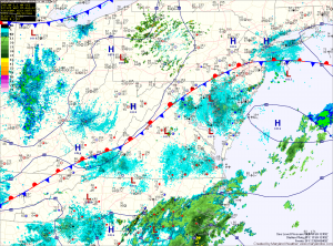
A cold front to our west will send areas of precipitation our way tomorrow, resulting in another day of scattered shower and thunderstorms. Highs again will be around 90.
The cold front moves closer and pushes through late Friday and Saturday. This will increase rain chances, making thunderstorms likely both days. Highs will be in the mid 80s.
The front clears and cooler and drier air follows for Sunday. Highs will be in the low to mid 80s under mostly sunny skies.
The humidity will build again on Monday ahead of the next weather system that looks to bring rain chances again late Tuesday.
