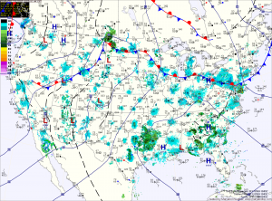
Unfortunately, the break in the heat is short lived. Expect the humidity to begin to build again tomorrow, with highs again in the low 90s.
Rain chances increase a bit as well, as a weak area of low pressure moves in from the west. The low will push through on Wednesday, bringing a better chance of thunderstorms in the afternoon and evening with highs in the mid 90s.
Behind the front, high pressure again sets up shop over the eastern US and temperatures will push back up into the mid to upper 90s for the end of the week and into the weekend.
