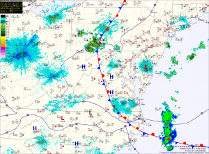
Also like yesterday, thunderstorms are expected to form over the mountains and move eastward, reaching the metro area by late afternoon. The primary threat from these storms will be strong winds and large hail.
A disturbance will move through tonight into tomorrow morning, bringing another chance of showers and possibly a thunderstorm. Expect the front to remain to our north tomorrow, allowing the entire state to push into the mid 80s with more scattered showers and thunderstorms possible during the afternoon.
The front moves back south on Saturday, continuing the chance of showers and storms. Highs near 80 are expected.
Sunday currently looks dry as the front settles south of the state, with highs in the low to mid 70s. Expect much of the same on Monday as the next storm system moves towards our area midweek.
