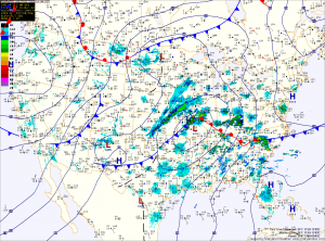
Showers will continue this evening and depending on whether the warm front moves through, thunderstorms are possible as well. Showers will continue into tomorrow morning as the cold front clears the area. Total rainfall from this system will be around three quarters of an inch, with higher amounts in thunderstorms.
Clearing will commence Saturday afternoon and temperatures will rise to near 60. Reinforcing shots of cold air will move through on Sunday and Monday with highs in the mid 40s both days.
Temperatures will remain in the mid 40s as we move into the middle of next week before warming again towards the end of the work week.
