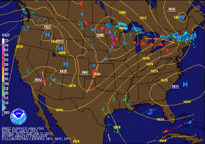
 The end of January and the beginning of February will feel like April, as highs today and tomorrow will push into the mid 60s. High pressure continues to move off the South Carolina coast allowing southerly flow to develop, bringing in the warm air. Meanwhile, a cold front will move through tomorrow night with a chance of showers, only to move back through on Thursday as a warm front and more widespread rain. Total rainfall of up to a half inch will be possible statewide.
Following that system, high pressure pushes back in, dropping temperatures back to the upper 40s to near 50 Thursday and Friday and cooling down to the mid 40s over the weekend. Rain chances increase on Sunday as another cold front moves through the region.
The models continue to hint at a pattern change as we head towards the end of next week with much colder air spilling into the Eastern US.
