A cold front is currently moving southward across the state, bringing in cold and dry air. Highs today will max out in the mid 30s. Clouds will continue to increase as a low pressure system moves towards the area. This system will bring wintry precipitation tonight as warm air moves over the top of the cold air currently working its way in.
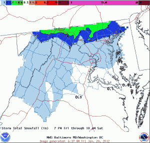
Expect snow to develop tonight, changing to sleet. Snow and sleet accumulations of up to an inch are possible across Central Maryland, including the Baltimore/Washington Metro. Lesser amounts as you move south and up to 3″ will be possible along the Mason-Dixon line. In the far western counties, a Winter Storm Warning is effect for a couple of inches of snow and sleet and up to a quarter of an inch of ice.
Here is the storm total snow/sleet accumulation map from the NWS:

As we move into the early morning hours tomorrow, the sleet will transition to freezing rain and eventually to plain rain as temperatures rise above freezing in most areas before ending during the afternoon hours.
There will be another shot of light wintry precipitation Sunday and Sunday night as more moisture moves in. This round looks to be very light and the cold air will not hold on as well as it will tonight and tomorrow.
Looking ahead to next week, it appears we will stay in an active and unsettled pattern as a cold front will cross the region Monday night and Tuesday and several minor disturbances follow it. High temperatures look to be in the mid 40s throughout the week.
