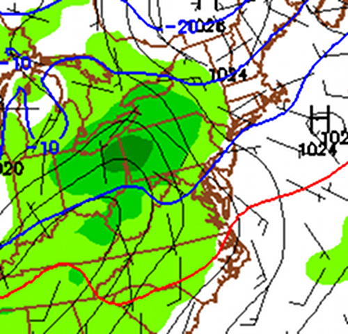
Today will see increasing clouds as another cold front moves through the region tonight. The front will have a little moisture with it, and will produce scattered flurries overnight as it crosses the state.
The main weather story is the storm system that will begin to affect the area tomorrow night.
As the low moves in and brings warm air aloft, high pressure over New England will help funnel cold air down the coast at the surface east of the mountains. This is commonly referred to as cold air damming. With the cold air wedged down the coast, and warmer air overrunning it, we have the setup for a wintry mix of precipitation.

Right now, the cold layer looks to be shallow and it will erode as we head towards Saturday afternoon but before it does, expect a mix of snow, sleet and freezing rain late Friday night and Saturday morning. The precipitation will change to rain as temperatures move above freezing on Saturday.
This will not be a crippling ice storm, but expect icy spots and adverse conditions for several hours tomorrow night and Saturday morning.
