Light Snow Expected Tomorrow

Current Surface Map
Current Surface Map

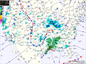
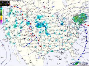
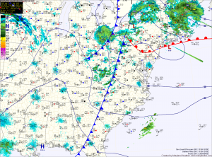
A fast moving area of low pressure will bring light snow to the area tomorrow.

The low is currently over eastern Texas and it will quickly move by to our south during the day tomorrow before it strengthens and moves towards New England.

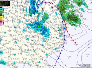
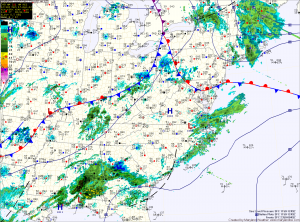
Expect light snow to develop during the pre-dawn hours tomorrow morning, mixing with or changing to rain in southern Maryland and the lower Eastern Shore.

The rain/snow line will approach the I-95 corridor by tomorrow afternoon and may push into the Baltimore/Washington metro areas.

One Storm Leaves, Another Takes Aim

Current Surface Map
Current Surface Map
As yesterday’s storm pushes northeastward and away from the area, another is taking shape over the Rockies and will move into the area by Saturday morning.

Behind the storm that brought snow, sleet, freezing rain and a lot of plain rain (storm total of 1.31″ here) to the region, skies will gradually clear as northwest winds gust to near 50mph today. A Wind Advisory is in effect until 6pm.

Winds will decrease tonight as weak high pressure builds in tomorrow, providing a calm and tranquil day. Highs will be in the low to mid 40s.

Precipitation will push into the area early Saturday morning. The models are in agreement that the initial precipitation will fall in the form of snow. The models disagree however, on if it will remain snow and how much will fall.

Windy and Cold Weekend

Current Surface Map
Current Surface Map
Today is the first day of winter and it will certainly feel like it!

The cold front that brought heavy rain and wind to the area last night has pushed off the coast and colder air is beginning to filter into the region.

Winds will increase through the day today as the storm intensifies to our north. Highs today were reached at 2:40 this morning and will continue to drop through the day, into the 30s this evening.

Winds will gust to around 30mph this afternoon, making it feel even colder. There may be a sprinkle or flurry this afternoon as well.

In far western Maryland, snow will continue to fall and combine with the strong winds to produce blizzard conditions at times through tomorrow.

Strong Cold Front Brings Rain and Wind

Current Surface Map
Current Surface Map
An intense area of low pressure continues to strengthen over the midwest while it drags a cold front across the country. The front will approach the area this afternoon spreading rain into the area by sunset.

The rain will be heavy at times, accompanied with strong gusty winds. A thunderstorm is possible during the overnight as well.

Winter begins at 6:12 tomorrow morning and the front will be pushing through around that time. Expect wind gusts to near 40mph tomorrow, as temperatures fall from the low 40s into the 30s during the day.

Sunny Today; Cold Front Passes Tomorrow Night

Current Surface Map
Current Surface Map
High pressure will control the weather today, providing sunny skies. It will be breezy, with highs in the mid 50s.

A strong storm system that will bring heavy snow to the midwest will begin to spread clouds into our area tonight. The clouds will thicken tomorrow as the storm brings a strong cold front through the region.

Rain will develop out ahead of the front and will spread into the area during the late afternoon. Highs will be in the mid to upper 40s.

The rain will continue tomorrow night and into Friday morning. In the mountains of far Western Maryland, it will be cold enough for snow. Winter Storm Watches have been issued for Garrett and Allegany counties where near blizzard conditions are expected into Saturday.

Decreasing Clouds; Cold Front Thursday Night

Current Surface Map
Current Surface Map
The system that brought the showers and foggy conditions to area continues to move away.

A cold front will push through this morning, clearing the leftover clouds and sprinkles. Highs today will be in the mid 50s.

Tomorrow will feature sunny skies as high pressure builds overhead. Highs will be in the ow 50s.

Clouds will increase on Thursday as a strong cold front approaches from the west. Showers associated with the front will move in late in the day and last through the overnight.

Showers Redevelop Today

Current Surface Map
Current Surface Map
After a foggy start to the day, another round of showers will develop this afternoon and last into tomorrow morning as another area of low pressure moves through the region.

Highs today will push into the mid 50s.

Showers will continue tonight and last through the morning tomorrow followed by partial clearing. Highs will be in the mid to upper 50s.

Wednesday looks to be the nicest day of the week, with mostly sunny skies and highs in the low 50s.

A strong cold front will approach on Thursday, spreading clouds and eventually showers into the area during the day. Highs will be in the low 50s.

Sunny Today; Unsettled Weather Ahead

Current Surface Map
Current Surface Map
High pressure will remain in control today and tomorrow, providing another sunny day today and allowing temperatures to climb to the low to mid 50s this afternoon.

Clouds begin to increase tomorrow as an area of low pressure approaches from the west. Highs will be in the low 50s.

Rain chances increase Saturday night and Sunday. Showers are likely during the day Sunday, with highs in the low 50s.

Showers will continue Sunday night into Monday as the first storm moves off to the northeast.

Sunny Today and Tomorrow; Rain Chances Increase this Weekend

Current Surface Map
Current Surface Map
Today and tomorrow will feature plenty of sunshine and near normal temperatures.

Highs today will be in the mid to upper 40s, warming into the low 50s tomorrow.

Saturday will be a transition day with clouds increasing through the day. Highs will be in the low 50s.

As an area of low pressure moves into the region, there is a slight chance of showers Saturday night and a better chance on Sunday. Highs will be around 50.

Partly Sunny Today; More Sunshine To End The Week

Current Surface Map
High pressure continues to move in from the west. As a result, a stretch of calm and pleasant weather is expected. Today will be partly sunny with highs in the mid to upper 40s.

The high moves overhead tomorrow and as a result we will see more sunshine than today. Highs tomorrow will be in the upper 40s.

Friday will also feature sunny skies, with highs around 50.

Clouds increase on Saturday as an area of low pressure approaches from the west. Highs will be in the low to mid 50s.