
For the first time this winter, the models are converging on almost a perfect storm track to bring a significant snowfall to our area. The only problem (for snow lovers) is that the cold airmass that is currently in place will move out to sea before it arrives.
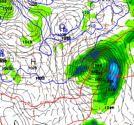 |
| The blue line is the freezing line. As you can see, central MD and points east are above freezing. |
With no strong cold air source to the west or north, and the storm bringing plenty of warmer air with it, our perfect storm track looks to bring mostly rain to areas east of the mountains.
As it looks right now, this should be a mostly rain event, with snow mixing at times and ending as a bit of snow. Here is the NWS forecast for central MD:
| Tuesday Night | A chance of rain and snow after midnight. Mostly cloudy, with a low around 30. East wind between 3 and 7 mph. Chance of precipitation is 40%. New precipitation amounts of less than a tenth of an inch possible. |
| Wednesday | Rain and snow likely, becoming all rain after noon. Cloudy, with a high near 37. North wind between 9 and 15 mph. Chance of precipitation is 70%. New precipitation amounts between a quarter and half of an inch possible. |
| Wednesday Night | Rain and snow likely before midnight, then a chance of snow. Mostly cloudy, with a low around 27. Chance of precipitation is 60%. New precipitation amounts between a tenth and quarter of an inch possible. |
The one certainty is that as this system pulls away, it will drag in another reinforcing shot of cold air for next week.